Future Options for the National Interstate And Defense Highways
The Transporation Research Boad completed this report prepared by PB Consult, Inc and Cambridge Systematic, May 2007, for the National Cooperative Highway Research Program (NCHRP) of the Transportation Research Board (TRB) of the National Academies. The work was sponsored by the American Association of State Highway and Transportation Officials (AASHTO) and the Federal Highway Administration (FHWA). A conclusion was that the capacity of the Interstate System needed to be increase in two parts defined as "expansion" {additional lanes and interchanged} and "extension" {extension of existing or totally new Interstate highways},
System Extent. The application of performance criteria in the context of the growth in demand and the specific functional needs of connections and continuity has indicated the need for an additional 173,000 lane miles of capacity to be added to the 210,000 lane miles of the existing Interstate System....this new capacity would be achieved in two ways:
· Expansion of the existing Interstate System, adding 88,600 lane miles within its existing 212,000 lane miles on 46,800 route miles.
· Extensions of the existing Interstate System, through upgrades of the national highway system (NHS) and related corridors, converting 15,000 route miles to the Interstate, involving an additional 84,400 lane miles.
In total, the future Interstate System would supply 385,000 total lane miles of capacity along a total system length of nearly 62,000 route miles. Accommodating the forecasted travel at the performance level used in this analysis implies the addition of about 5,760 lane miles per year.
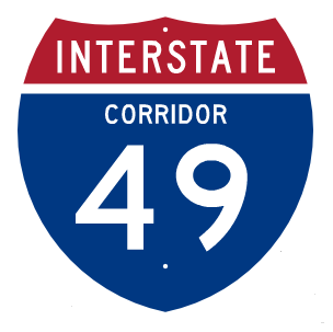
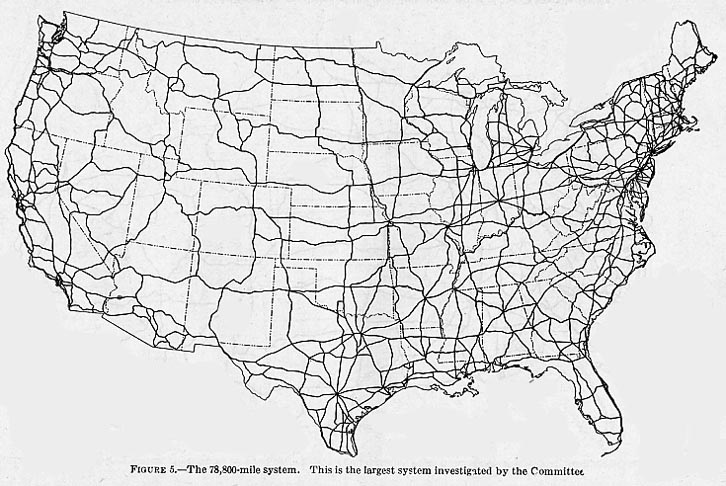
The Interstate System was never a "fixed" system, but has evolved from its inception as the Inter-Regional System, to additions replacements of routes like I-67 into I-69, the extension of I-70 from I-25 in Denver to I-15 in Utah, and I-12 as an intercontinental bypass north of New Orleans. The Federal Aid Highway Act of 1968 added 1500 miles that created I-49 and I-22. The Federal Aid Highway act of 1988 and ISTEA 1991 planned the extension of I-49 from Shreveport to Kansas City and I-69 from Indianapolis to Texas. The new Future Interstate Study will create totally new numbered Interstates as well of extending existing Interstate. Most of these routes will follow the existing National Highway System (NHS) corridors, but will also follow non-NHS corridors to increase capacity to relieve BOTH congested urban and rural routes. The new Interstate mileage corridors may increase the Interstate system to about 15,000 miles or more. The estimated Future Interstate System may total 67,000 miles. The new routes will match similar routes suggested in the large 78,000 mile system studied in 1941 Inter-Regional System. This is not surprising since the 78,000 mile Inter-Regional network was based on interconnecting the majority of cities that were strategic to the defense of the United States as submitted by General Pershing (and his aid Dwight Eisenhower, the future President and "father" of the Interstate System.
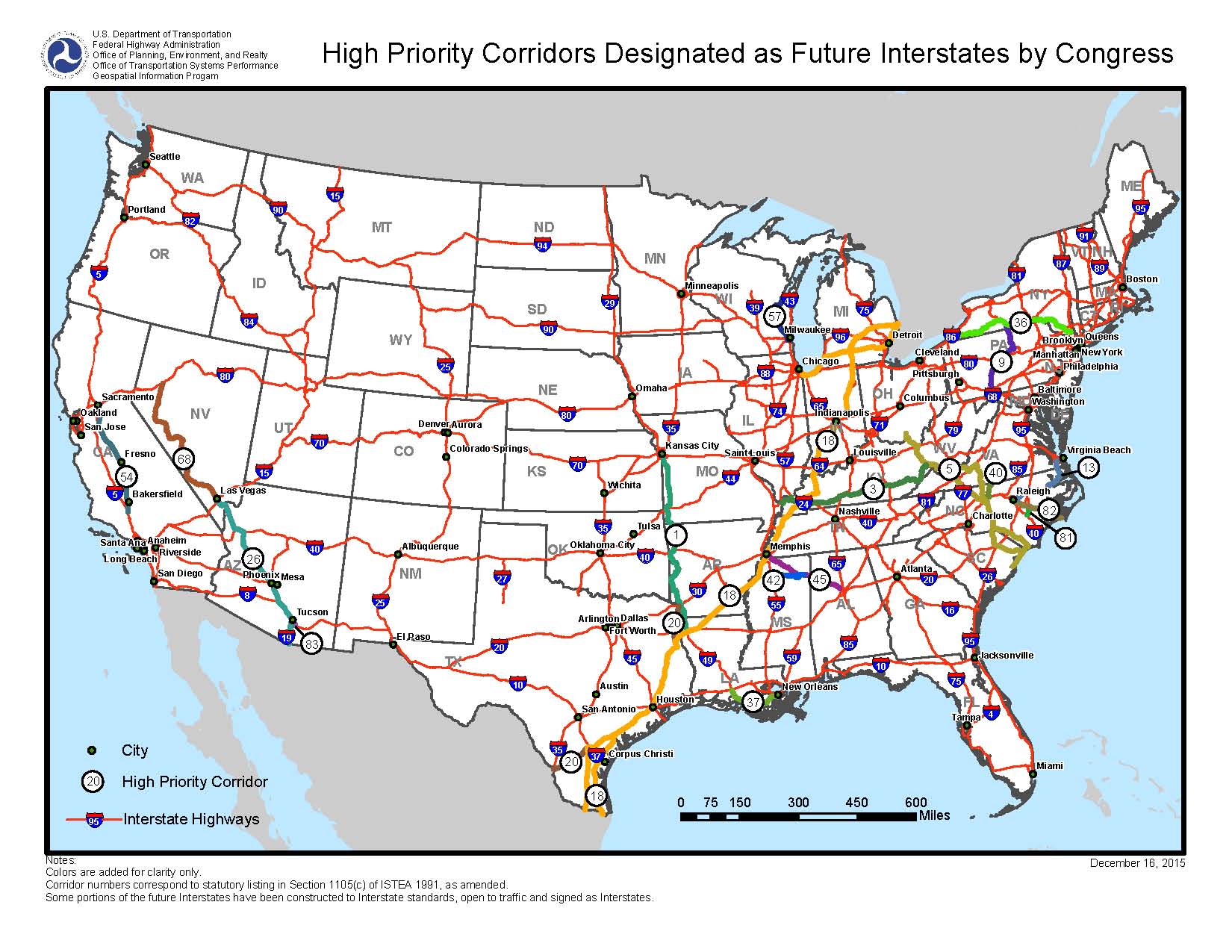
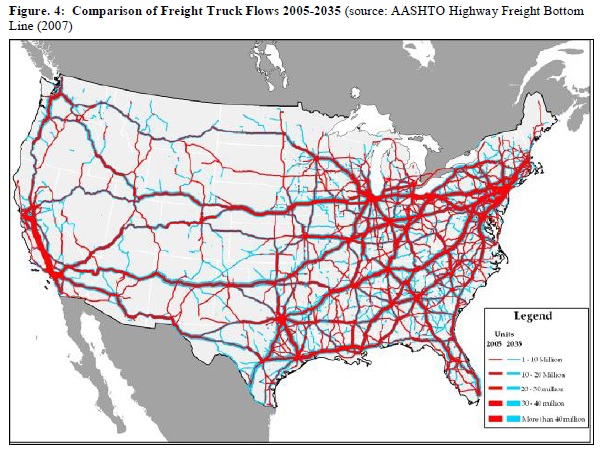
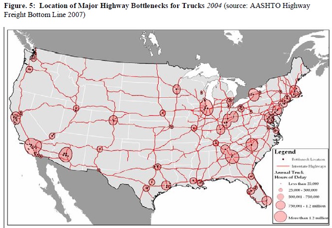
Section 6021 of the new Fixing America's Surface Transportation Act of 2015 has commissioned the Transportation Research Board to conduct a detailed study on the actions needed to upgrade the original "Dwight D. Eisenhower" National System of Interstate and Defense Highways to meet the growing new highway demands of the 21st century. In the 2007 study, the major freight truck corridor and the truck traffic bottleneck cities are shown in the tow maps below.
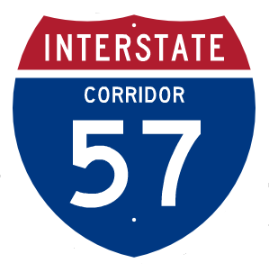
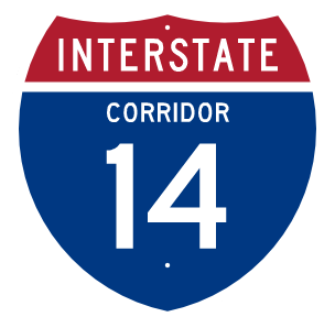
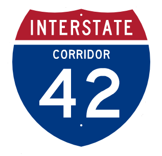
The Congress decided to completely study the need improvements to the Interstate System for the 21st Century, INCLUDING upgrading National Highway System (and some non-NHS corridor were needed) to Interstate Highway standards both by extending existing Interstate or adding totally new numbered Interstates (like I-42 and I-87 in North Carolina, I-14 in Texas, I-57 in Arkansas) in the 2015 FAST Act. The Transportation Research Board suggest an additional 15,000 miles in its 2007 study:
Section 6021 of the Fixing America’s Surface Transportation (FAST) Act of 2015
SEC. 6021. FUTURE INTERSTATE STUDY.
(a) FUTURE INTERSTATE SYSTEM STUDY.—Not later than 180 days after the date of enactment of this Act, the Secretary shall enter into an agreement with the Transportation Research Board of the National Academies to conduct a study on the actions needed to upgrade and restore the Dwight D. Eisenhower National System of Interstate and Defense Highways to its role as a premier system that meets the growing and shifting demands of the 21st century.
(b) METHODOLOGIES.—In conducting the study, the Transportation Research Board shall build on the methodologies examined and recommended in the report prepared for the American Association of State Highway and Transportation Officials titled ‘‘National Cooperative Highway Research Program Project 20–24(79): Specifications for a National Study of the Future 3R, 4R, and Capacity Needs of the Interstate System’’, dated December 2013.
(c) CONTENTS OF STUDY.—The study— (1) shall include specific recommendations regarding the features, standards, capacity needs, application of technologies, and intergovernmental roles to upgrade the Interstate System, including any revisions to law (including regulations) that the Transportation Research Board determines appropriate; and (2) is encouraged to build on the institutional knowledge in the highway industry in applying the techniques involved in implementing the study.
(d) CONSIDERATIONS.—In carrying out the study, the Transportation Research Board shall determine the need for reconstruction and improvement of the Interstate System by considering—(1) future demands on transportation infrastructure determined for national planning purposes, including commercial and private traffic flows to serve future economic activity and growth; (2) the expected condition of the current Interstate System over the period of 50 years beginning on the date of enactment of this Act, including long term deterioration and reconstruction needs; (3) features that would take advantage of technological capabilities to address modern standards of construction, maintenance, and operations, for purposes of safety, and system management, taking into further consideration system performance and cost;(4) those National Highway System routes that should be added to the existing Interstate System to more efficiently serve national traffic flows; and (5) the resources necessary to maintain and improve the Interstate System, including the resources required to upgrade the National Highway System routes identified in paragraph (4) to Interstate standards.
(e) CONSULTATION.—In carrying out the study, the Transportation Research Board— (1) shall convene and consult with a panel of national experts, including operators and users of the Interstate System and private sector stakeholders; and (2) is encouraged to consult with—
(A) the Federal Highway Administration;
(B) States;
(C) planning agencies at the metropolitan, State, and regional levels;
(D) the motor carrier industry;
(E) freight shippers;
(F) highway safety groups; and
(G) other appropriate entities.
(f) REPORT.—Not later than 3 years after the date of enactment of this Act, the Transportation Research Board shall submit to the Secretary, the Committee on Environment and Public Works of the Senate, and the Committee on Transportation and Infrastructure of the House of Representatives a report on the results of the study conducted under this section.
(g) FUNDING.—From amounts authorized to carry out the Highway Research and Development Program, the Secretary shall use to carry out this section not more than $5,000,000 for fiscal year 2016.
The Transportation Research Board investigaged new Interstate corridors ranging from extending the existing Interstate Corridors created by Congress since 1991, upgrades of existing US Routes in the National Highway System (NHS) to future intersate standard highways and completely new terrain future intersate corridors not associated wit any existing highway in the NHS. All of these new corridors will be created as alternate relief routes to existing high traffic Interstate highway, to increase the capacity of NHS routes that have increased traffic, and in some cases, to provide new economic trade corridors. Many of these corridors have be recognized as vital since the 1941 study of a 78,000 mile interstate highway system that was the basis for the 45,000 mile system approved in the 1957 Interstate Higway System.
Future Interstate Historical Corridors
The Future Interstate Historical Corridors alleviate traffic congestion, fosters economic growth and commemorates historical cultures that struggled for the freedom in the United States of America. The Transportation Research Board concluded the nation's interstate highway system needs to increase the efficiency of traffic flows to lead to more prosperity. Congress needs to commemorate historical cultures that struggled through injustice to achieve freedom in America.
By creating additional interstate corridors strategically located to divert traffic away from congested areas while connecting regions with untapped economic potential, we unlock opportunities for growth in low populated areas. The improved transportation infrastructure leads to increased job creation, enhanced trade opportunities between states, and overall economic prosperity. Investing in these new corridors now produces sustained economic development across various industries of tourism, manufacturing, agriculture, and high technology. Beyond the purely practical considerations, these future interstate corridors present an incredible opportunity to commemorate our nation's diverse historical cultures and event.
The future interstate corridors will be expensive, however new renewable electrical power systems build along these corridors can achieve both reducing environmental impact while at the same time provide a new revenue source to cover the cost of their construction. Building solar farms along the paths of these corridors, located every 50 miles produces clean energy for electric vehicle charging independent of fossil fuels where the excess power not used for electric charging can be sold to local utilities. A 300-mile highway with 640-acres of solar farms stretched over a 50-mile interval can produce $1 billion per year that can be paid into the Federal Aid Highway Trust fund and state transportation departments based on an agreed cost share formula. The solar farm system can be built as soon aht the routes are selected and approved in the Draft and Final Environmental studies. Constructing the solar farms can be paid initially by Federal grants or loans which can be repaid within 2 years after completion by immediately selling power to the local grid. After the initial 2 year payoff period, the revenue can be paid into the Federal-Aid Highway Trust fund and state transporation budget to pay for detailed engineering design and during actual construction which typically takes about 5 years. Highway construction cost can be paid as-you-go over a 3-6 year period depending on the cost per mile. After construction costs are covered the revenue then continues into the Federal-Aid Highway Trust Fund and state budget to maintain the highway and help build other highway projects. A state is free to form public-private-partnerships, regular state bonds and tolling if the project will exceed the revenue rate, although this last option should be used as a last resort, and the tolls removed when basic construction costs are paid-off.
.jpg)


.jpg)