Future I-76 Lincoln Highway Historical Corridor
U.S. 30 Freeway Conversion
U.S. 31 Free-Flow Expressway
U.S. 231 Mid-State Corridor
|
.jpg)

History of I-76 and I-80 in OhioI-76 was created when I-80 was realigned in Ohio by 1962, joining the Turnpike west of Cleveland. I-80N was planned to split from I-80 near Kent and run northwest to Cleveland along OH 14. The new alignment of I-80 followed the Ohio Turnpike between the crossing west of Youngstown and OH 14. I-80 west of Youngstown became I-80S from Akron west to I-71 east of Lodi; the rest of proposed I-80 west to Norwalk (which would have crossed I-71 near was removed from the Interstate Highway System in 1971, I-80 was moved to the Turnpike between Streetsboro and southwest of Cleveland; the old route became I-480. I-76 begins at an interchange with I-71 east of Lodi, Ohio cosigned with US 224. The interstate travels east across Medina County before entering Summit County. In Akron, Interstate 76 runs concurrently with I-77 for approximately 3 miles before it becomes its own road again. I-76 continues east through the Akron suburbs and runs a rural route to just west of Youngstown, where it intersects with Interstate 80 and the Ohio Turnpike. Interstate 76 eastbound traffic exits the freeway alignment to join the Ohio Turnpike. Travelers who remain on the freeway alignment transfer to I-80 which leads through the northern Youngstown suburbs and into Pennsylvania via the Keystone Shortway. I-76 travels southeast once joining the Ohio Turnpike as it directly connects to the Pennsylvania Turnpike. History of I-67I-67 was part of the original Interstate numbering plan in 1957 for a route from Kalamazoo, Michigan, to Elkhart, Indiana. A planning map shows a freeway along this routing intersecting the Indiana Toll Road just west of the State Road 19 interchange. The Michigan State Highway Department officially requested switching the I-67 designation to a route from Benton Harbor to Grand Rapids in 1958, and in the process proposed the current I-69. The I-67 designation was denied by AASHO which then assigned I-196 to the Benton Harbor to Grand Rapids route, west of the I-96 junction near Grand Rapids. 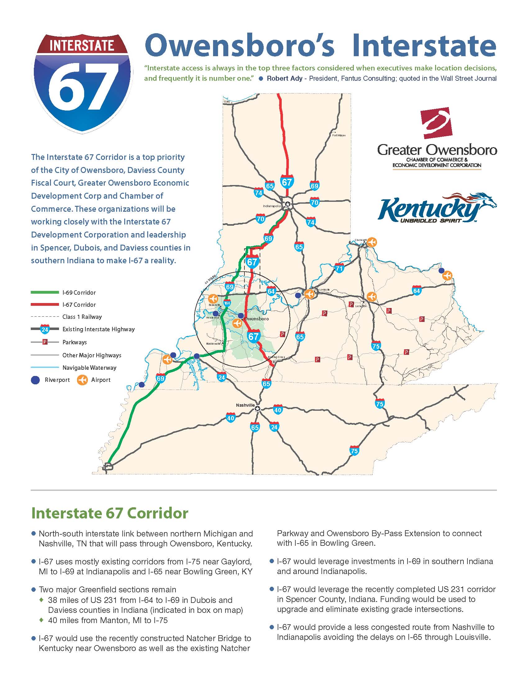
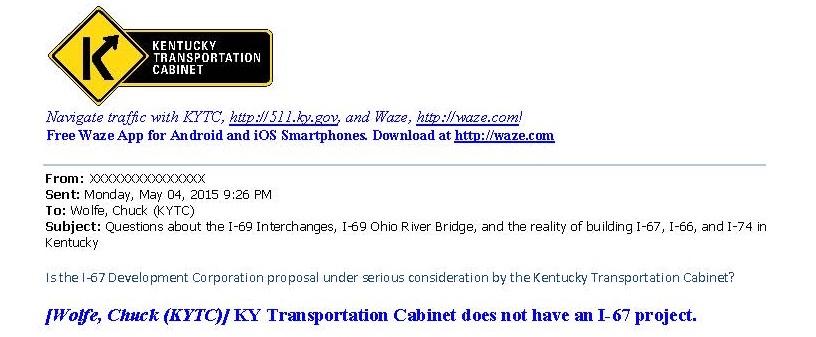
I-67 Development Corporation Concept in KentuckyI-67 Development Corporation was formed in 2011 to advocate running I-67 south concurrently with I-69 from Indianapolis to Washington, then extending a new terrain route to US 231 into Owensboro, Kentucky. From there, this I-67 would follow the William Natcher Parkway to I-65 in Bowling Green, Kentucky. The I-67 Develoment Corporation conducted the I-67 Corridor Feasibility Study. Neither the Kentucky Transportation Cabinet or the Indiana Department of Transportation had any interest in building a new terrain freeway through Indiana to Owensboro. The Kentucky Transportation Cabinet instead requested the Congress to establish two Interstate Corridors to Owensboro, I-369 conversion of the Audubon Parkway and the I-565 conversion of the William Natcher Parkway. 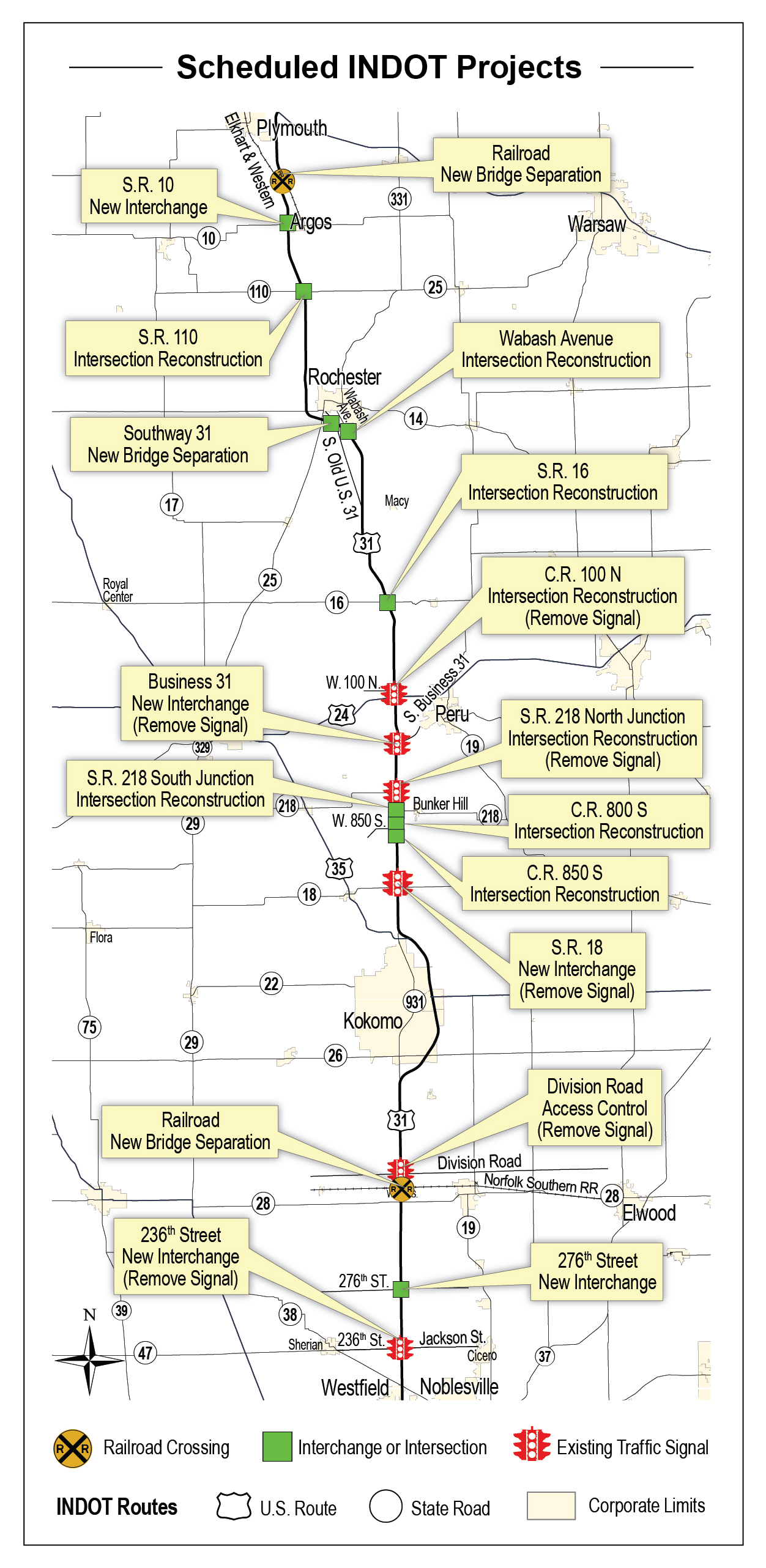
US 31 "Free-Flow" ExpresswayThe Indiana Senate unanimously passed a resolution in 2003 requesting the I-67 designation for US 31 between Indianapolis and South Bend. INDOT concluded that converting U.S. 31 to a "free-flow expressway" can be achieved at lower cost, in much less time, and with far less impact on existing homes and businesses while achieving the same benefits as a freeway, and has removed the concept of Interstate 67 in the state long-term transportation plans. A "free-flow" expressway removes all traffic signals and rail crossings at a fraction of the cost of upgrading the highway to interstate-freeway standards. INDOT estimated that an interstate-standard freeway would cost as much as four to five times more with little added benefit. An interstate-standard freeway would require years of federally mandated environmental review that would delay the project and needed safety improvements. A freeway would require more private property, forcing more people from their homes, require more businesses to close or relocate, and reduce the amount of property available for future development. 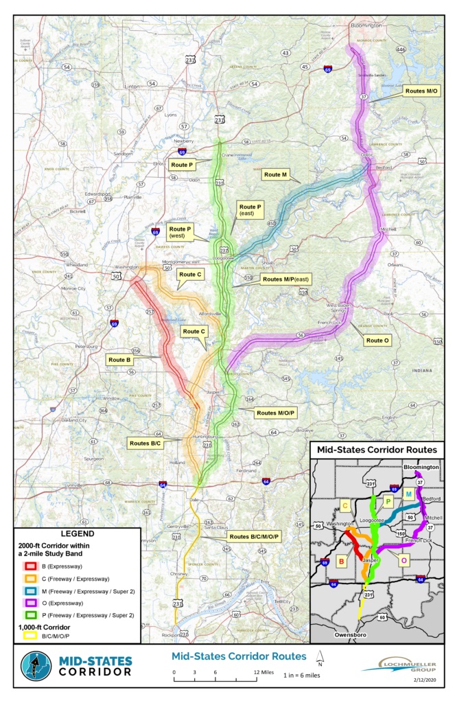
US 231 Mid-State CorridorInDOT began the plans to upgrade US 231 in Dubois County in 2004. Local politicians petitioned the concept of I-67 in 2012 and formed the I-67 Development Corporation. It was not seen as feasible to upgrade US 231 to a full interstate freeway. However 2014 Blue Ribbon Panel Report concluded that upgrading US 231 was a project of statewide significance. It a great deal of broad support from business leaders and public officials more than any other southern Indiana project in the Blue Ribbon Panel Report. The US 231 upgrade project is a new/upgraded four-lane road from the Ohio River at Rockport to I-69. It begins at the existing four-lane US 231 Ohio River Bridge in Spencer County (Rockport). About 26 miles (between the Ohio River and I-64) is an upgrade of the existing four-lane US 231 in Spencer County. At least 30 miles of it (north of I64) connects with I-69. Possible connection points are at Petersburg, Washington, Crane or Bloomington (via a connection to SR 37 south of Bedford or Mitchell). InDOT dropped the freeway option as too expensive for the projected traffic, and has instead decided for the "free-flow" expressway option like US 31 from Indianapolis to South Bend. |
|---|---|
Indiana
|
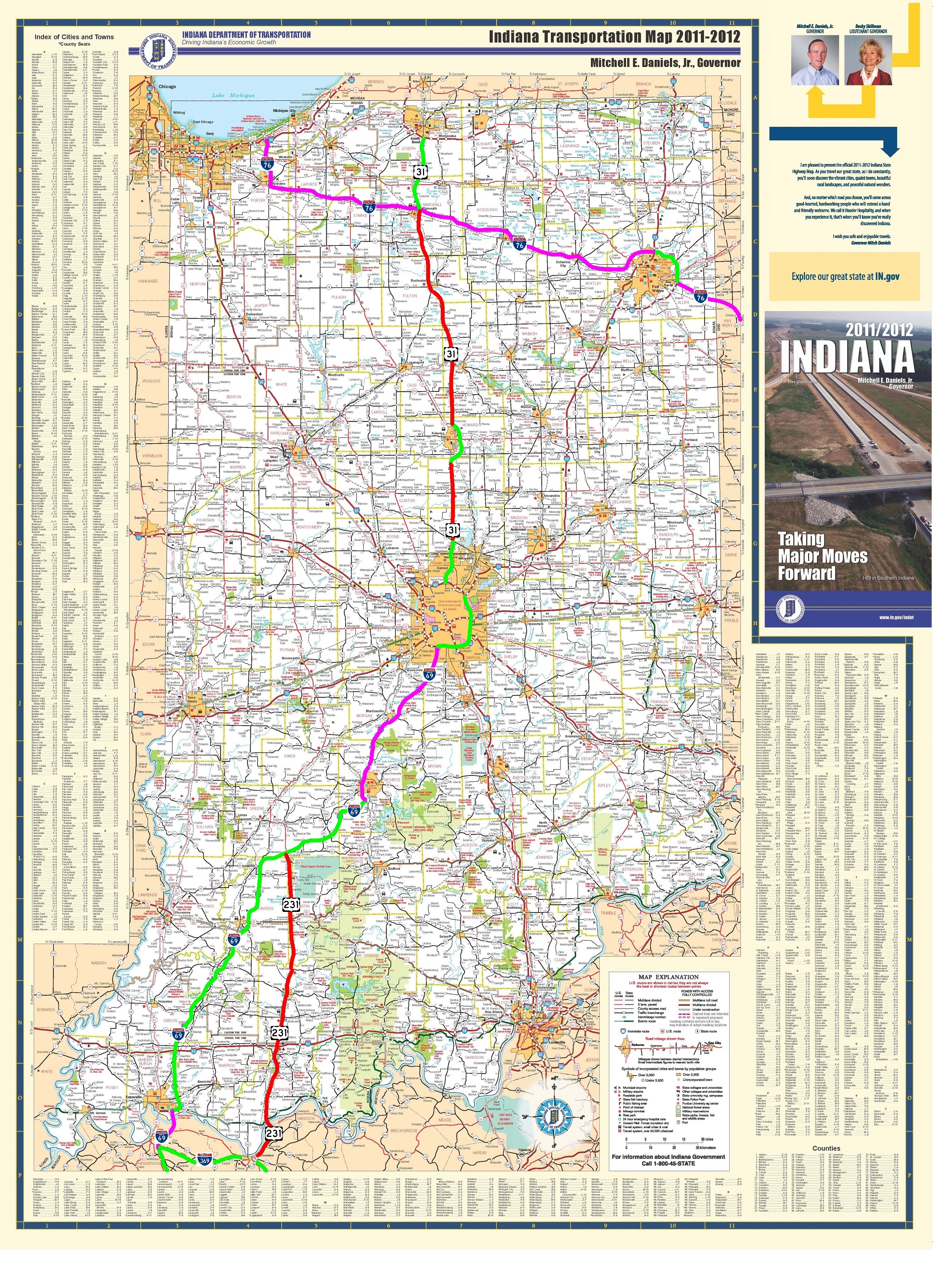
I-76 West ExtensionI-76 would continue along US 30 to I-469 around Ft Wayne Indiana. I-76 runs north of the city along I-469 and I-69 with US 30 before continuing west with US 30 through Indiana up to IN 49 in Valparaiso. I-76 would then parallel IN 49 to the I-80/I-90 Indiana Toll-Road and I-94 east of Gary Indiana. |
Ohio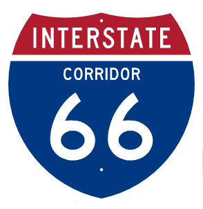
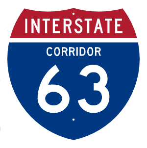

|
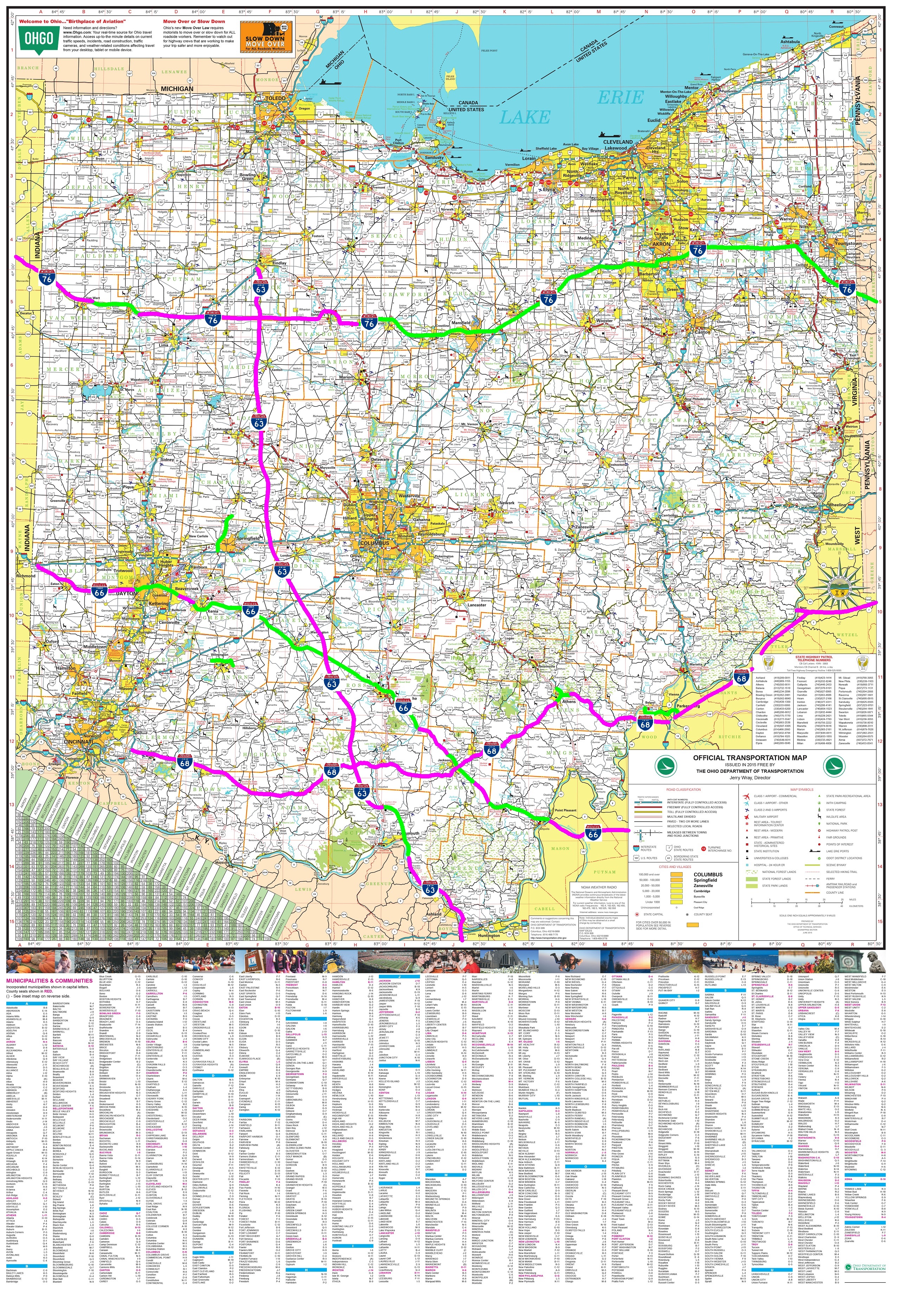
West Extension of I-76 through OhioI-76 is the conversion of US 30 to a freeway from I-71 to the Indiana border. Most of US 30 is already a four-lane limited access freeway, however many section will require upgrading to Interstate standards. US 30 crosses I-75 over the Norfolk Southern railroad with no direct access to I–75. The US 30 interchange with SR 696 provides the only access to both I–75. The major improvement required is to provide a full interchange between I-76 and I-75. US 30 is a four-lane divided highway to Van Wert County that will need a complete upgrade to interstate standards. |
Missouri
 |
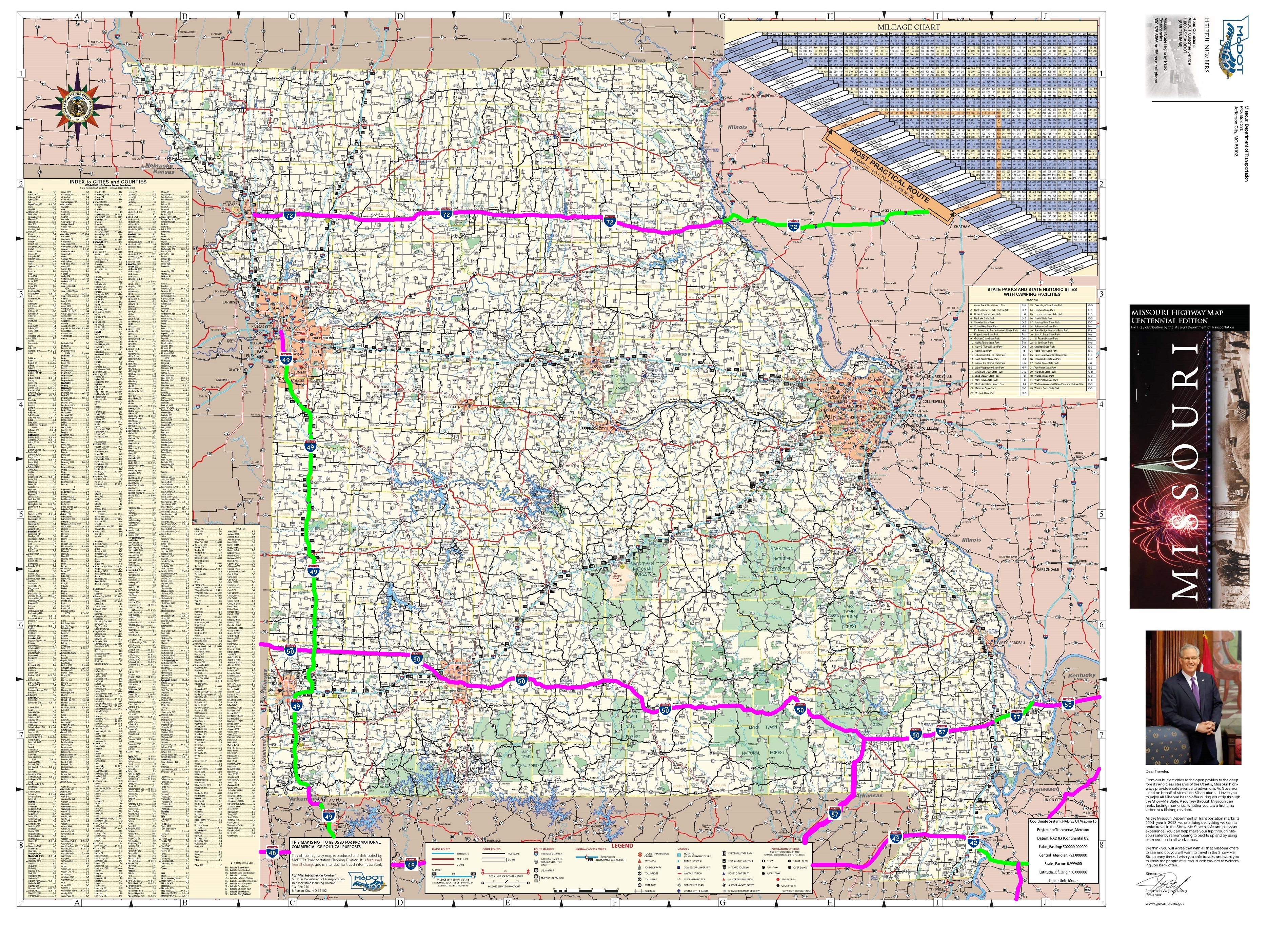
History of the I-72 Chicago to Kansas City Expressway ConceptThe Chicago to Kansas City Expressway was the proposed upgrade of US 36 to I-72, a rural four-lane highway across northern Missouri and west central Illinois from Cameron, Missouri at I-35 to Springfield, Illinois at I-55. This would provide a series of rural 4-lane highways (I-35, US 36, I-72, and I-55) connecting Chicago to the North American Free Trade Agreement (NAFTA) Corridor (High Priority Corridor 23). This would reduce the amount of through traffic, primarily truck traffic, in the St. Louis, Des Moines, and Quad Cities metropolitan areas by serving as an alternate route for I-70 and I-80. The Missouri portion of this route is designated as part of High Priority Corridor 61. When US 36 is upgraded to Interstate standards across Missouri, the future western terminus of I-72 would be at Cameron, Missouri at the intersection with I-35. Currently, the west end of I-72 route is west of US 61 and flows concurrent with US 36 into Illinois. In 2004, US 36 was upgraded to a 4-lane expressway between US 61 and US 24 at the Rocket Junction. This expressway is upgraded to interstate standards August 2007. Western Extension of I-72The future extension of Interstate 72 through Missouri from Hannibal to St. Joseph was designated as NHS High Priority 61 High Priority Corridors in Missouri:A. I-70, from I-29/I-35 to US 61/Avenue of the Saints. B. I-72/US 36, from the intersection with I-29 to US 61/Avenue of the Saints {I-72 in this map}. C. US 67, from I-55 to the Arkansas State line {now designated as the Future I-57 Interstate Corridor by Congress} D. US 65, from US 36/I-72 to the East-West TransAmerica corridor {I-51 in this map}. E. US 63, from US 36 and the proposed I-72 to the East-West TransAmerica corridor F. US 54, from the Kansas State line to US 61/Avenue of the Saints {I-51 in this map}. I-72 extenstion was listed on Marion County’s five-item transportation list that was finalized during the County Commission’s Feb. 16 meeting at the courthouse in Palmyra. Marion County’s “wish list,” which is reviewed and updated as needed annually, will be added to the list of priorities from seven other counties — Audrain, Macon, Monroe, Pike, Ralls, Randolph and Shelby — served by the Mark Twain Regional Council of Governments. Those approximately 40 priorities will then be ranked by the Transportation Advisory Committee (TAC), which consists of two members — a county commissioner and a private citizen — from each of the eight counties....the Missouri Department of Transportation (MoDOT) will then review all the proposed project lists submitted from across the state. Marion County’s newest addition to its priority list would see U.S. 36, from the Mark Twain Memorial Bridge in Hannibal to where U.S. 36 and 24 split near the Rocket Plaza, designated as I-72...To accommodate the I-72 designation request the Commission combined two other requests, both of which have to do with improved lighting. Additional illumination is being requested on U.S. 36 at the west end of Monroe City where Business 36 meets U.S. 36. |
Future I-50/I-60/I-70 Transcontinental Pioneer Corridor

|
Future I-18 Acadian-Tejas Corridor, Future I-53 Mississippi River Mound Builders Corridor

|
|---|---|
Future I-66/I-68 Ohio River Mound Builders Historical Corridor
|
Future I-63 Emancipation Underground Railroad Historical Corridor
|
Future I-14 Gulf Coast Strategic Highway Corridor
|
Future I-76 Lincoln Highway Historical Corridor
|
Future I-49 Corridor
|
Future I-27 Ports to Plains Corridor, Future I-31 Great Plains Corridor, Future I-2
|
Future I-42 Conversion of U.S. 412 and U.S. 70
|
Future I-69
|