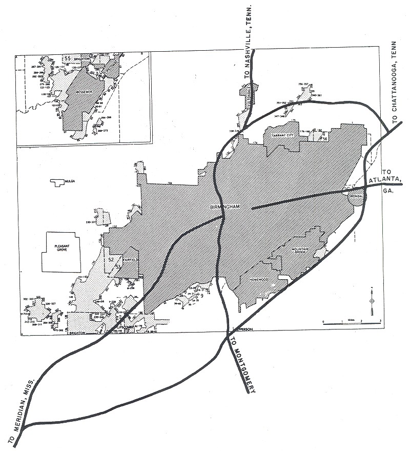
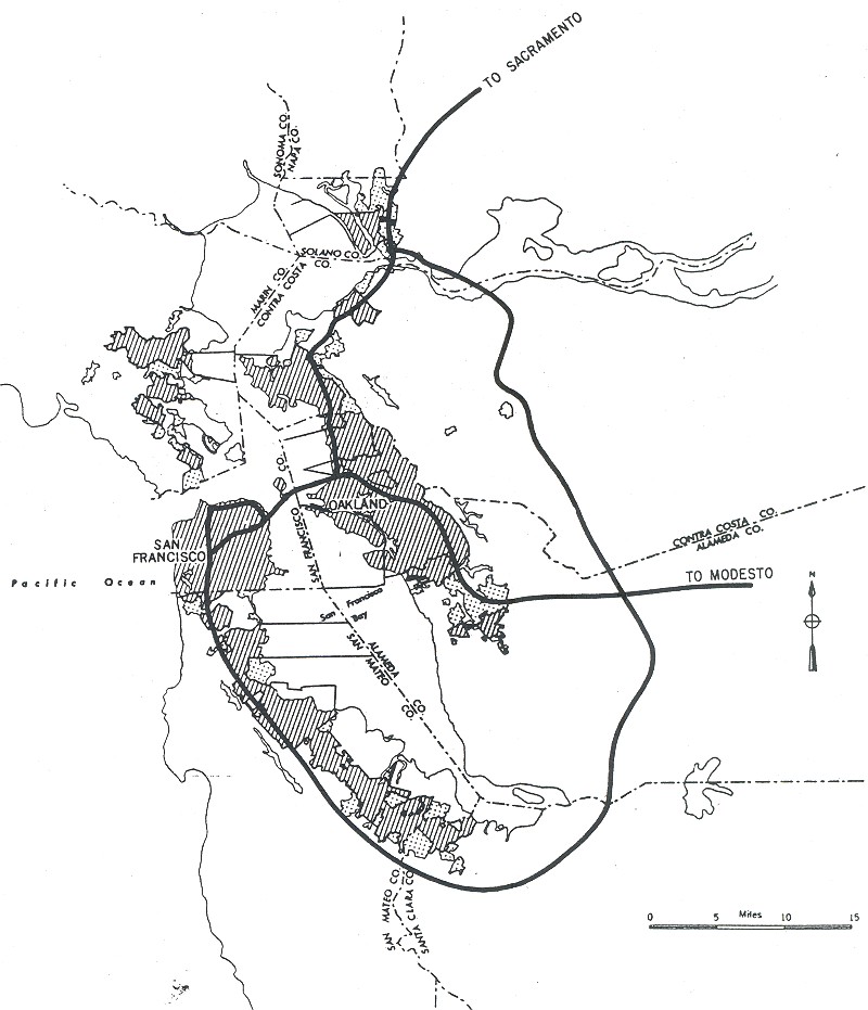
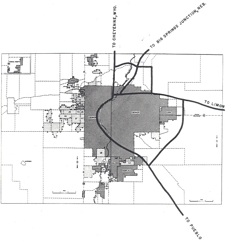
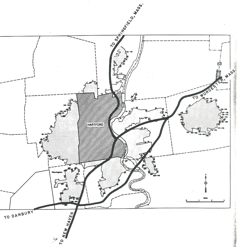
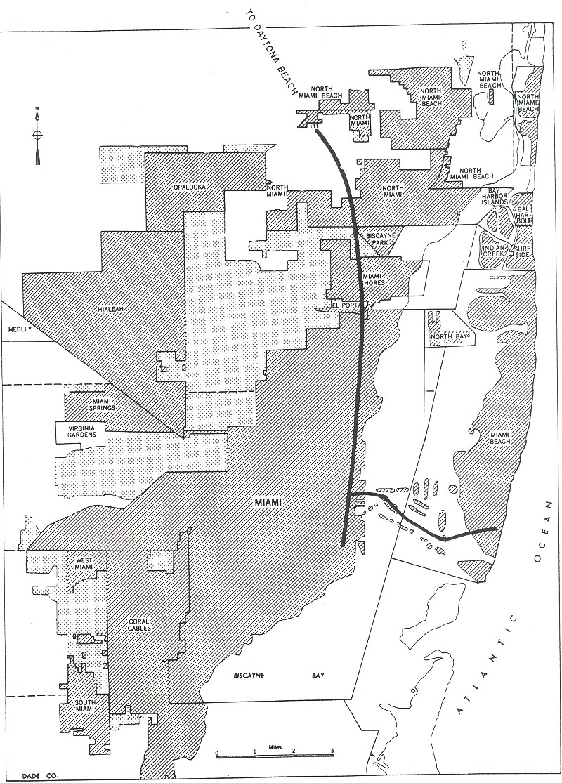
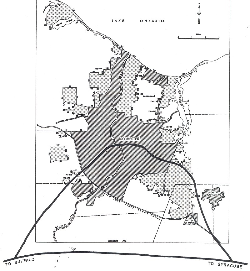
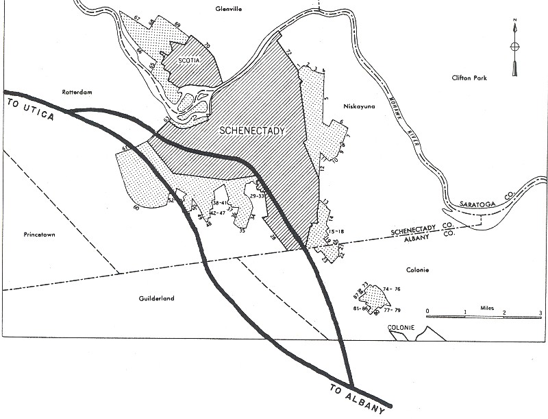
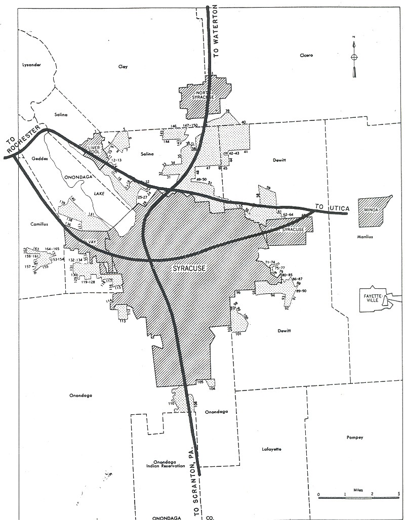
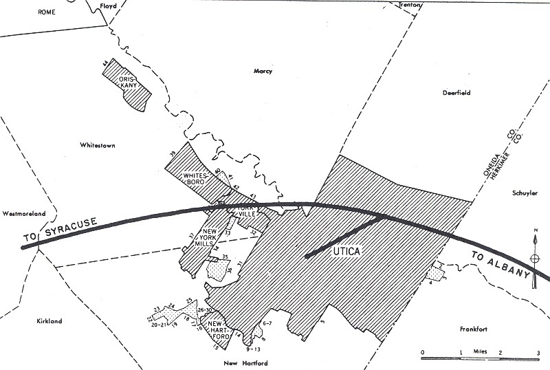
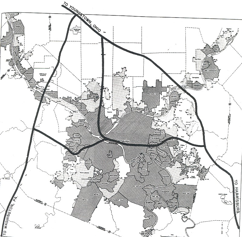
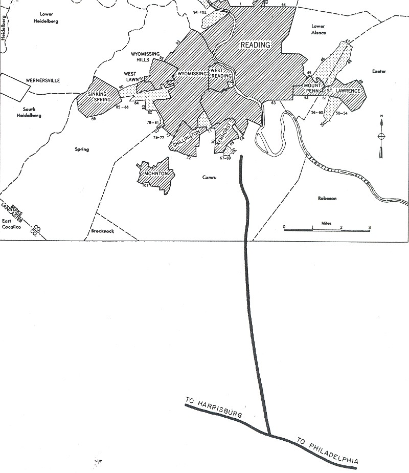
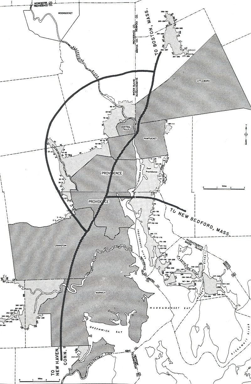
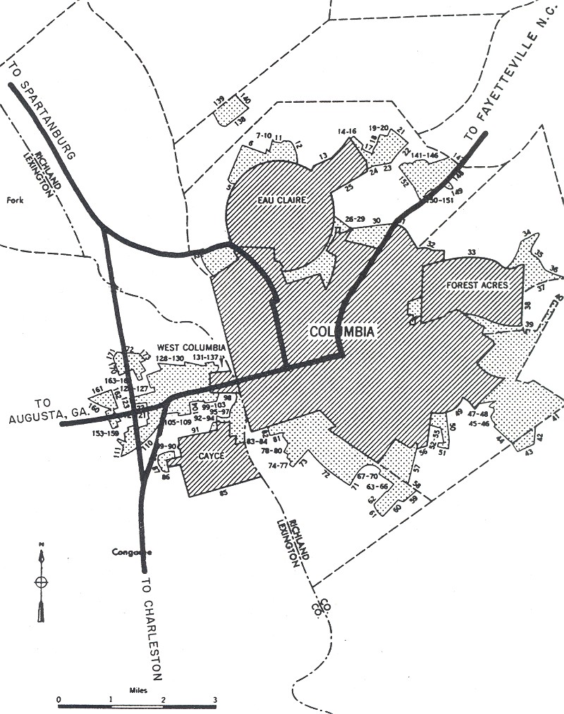
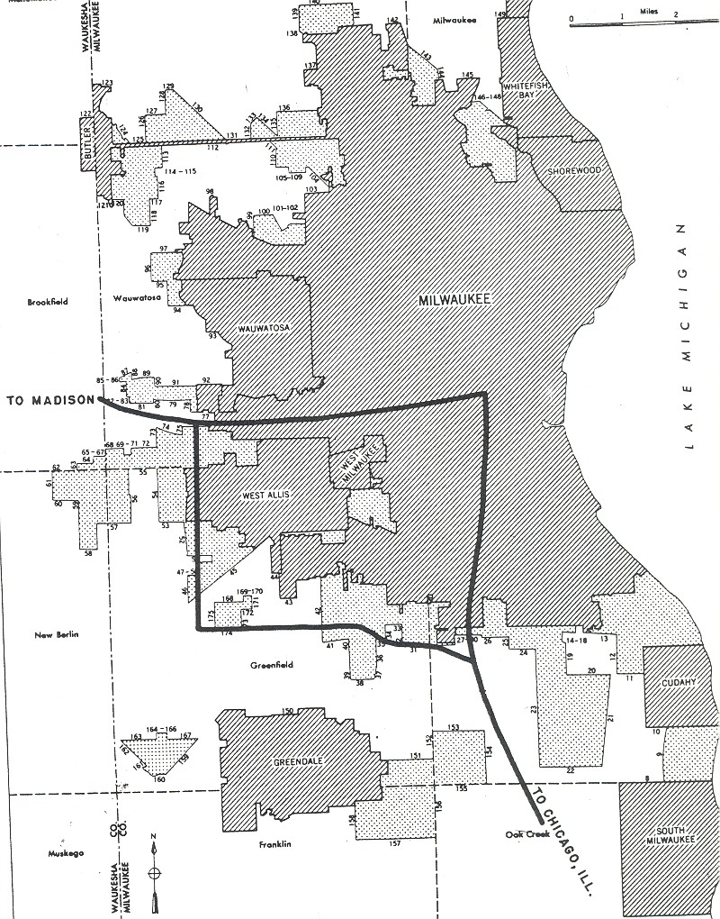
Interstate Highway System Urban Freeway Map from the Yellow Book
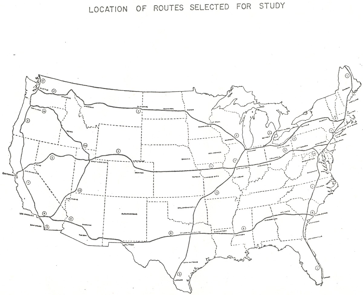
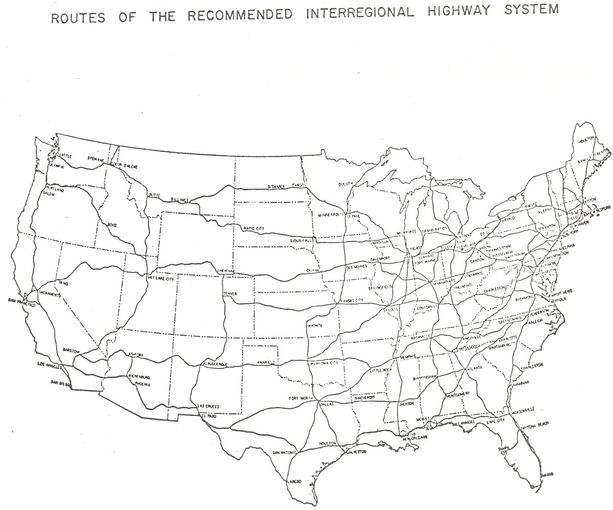
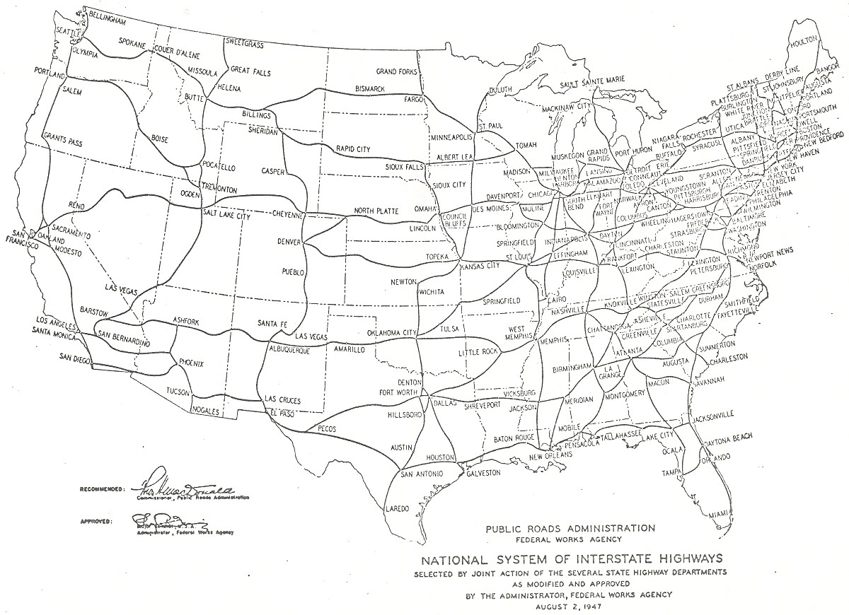
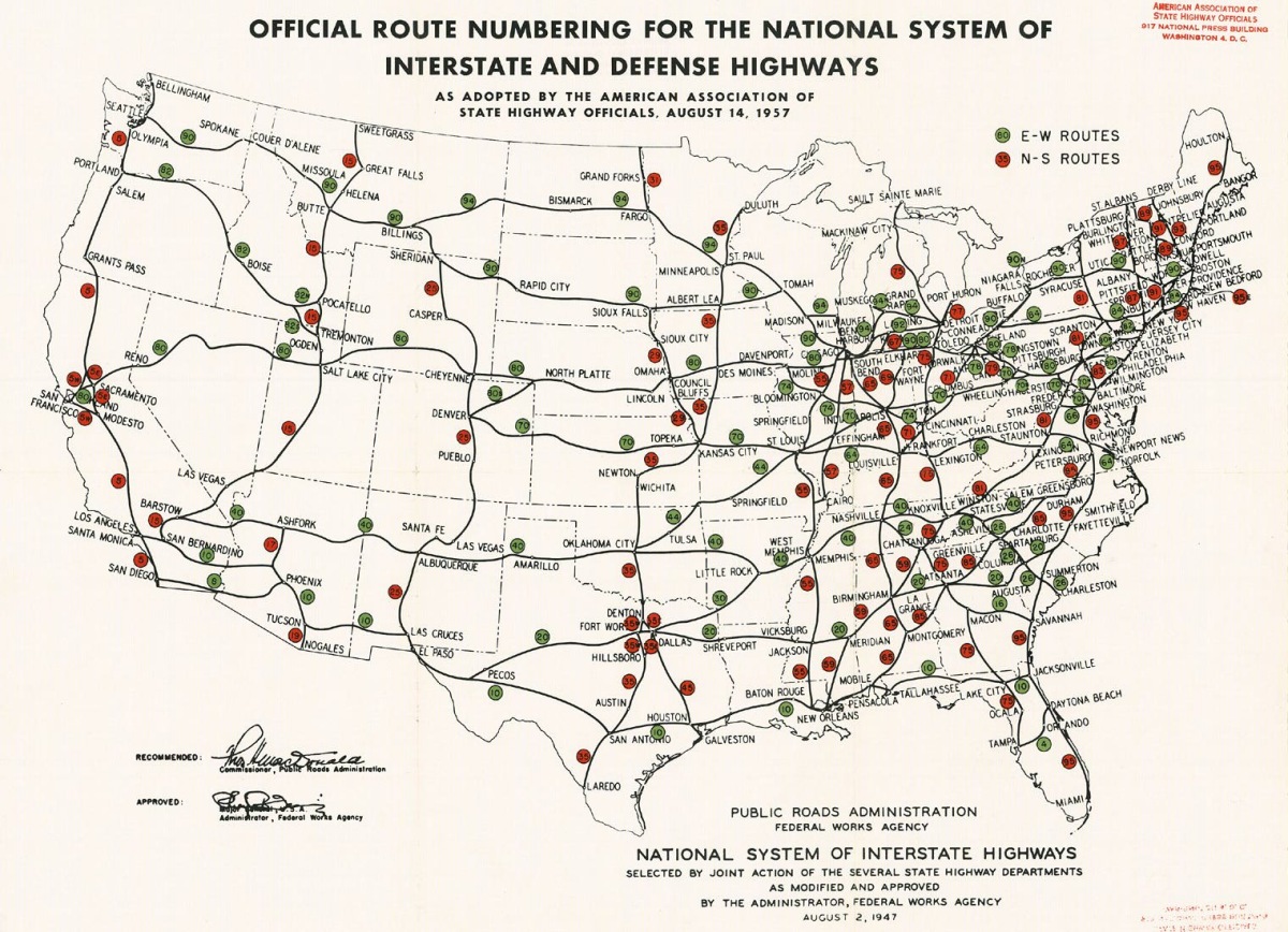
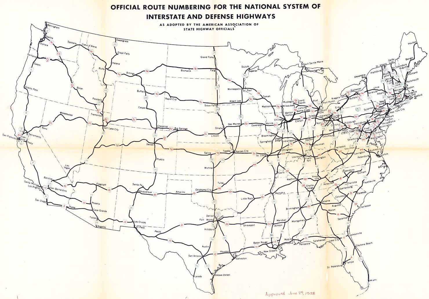
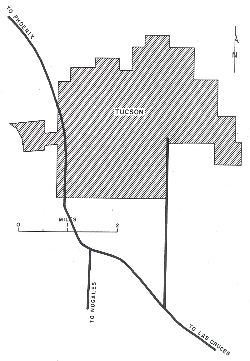
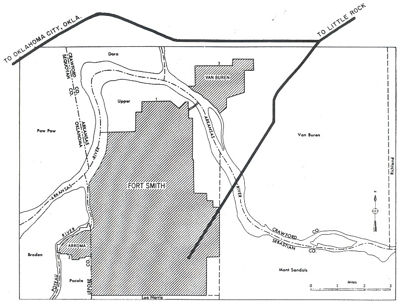
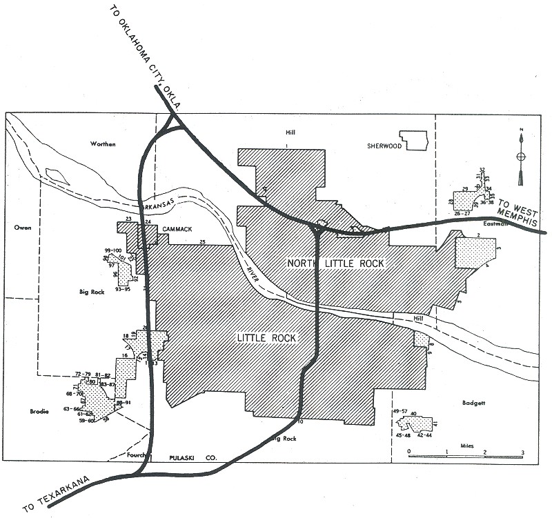
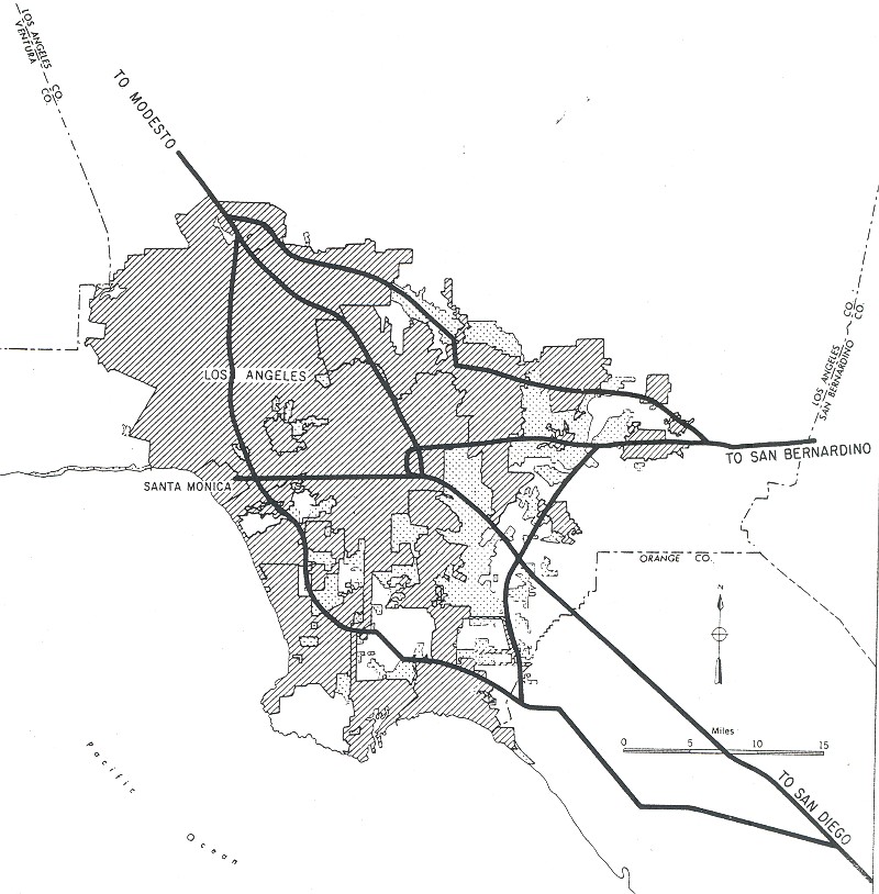
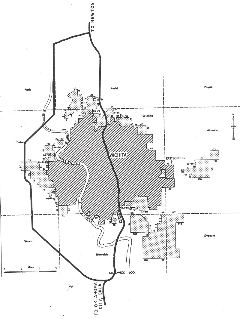
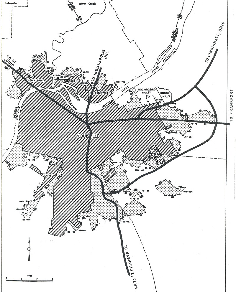
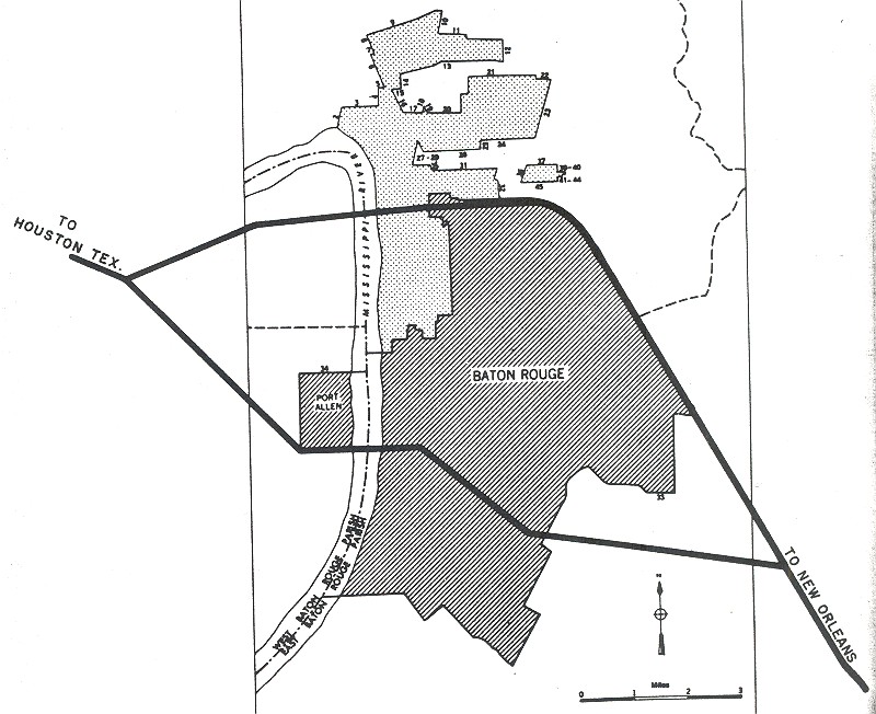
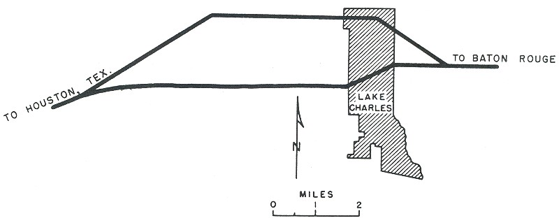
Maps of the Interstate Highway System and the urban freeway plans were detailed in the 1955 "Yellow Book". :
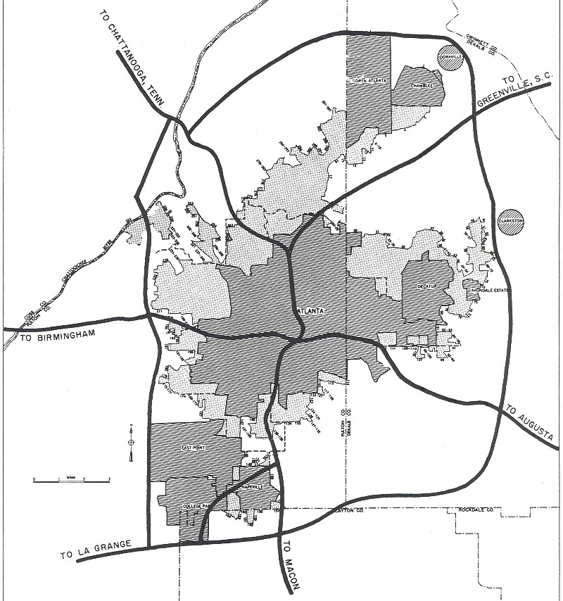
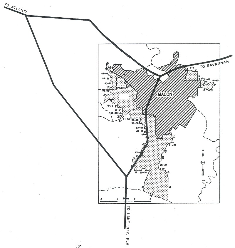
The national system:
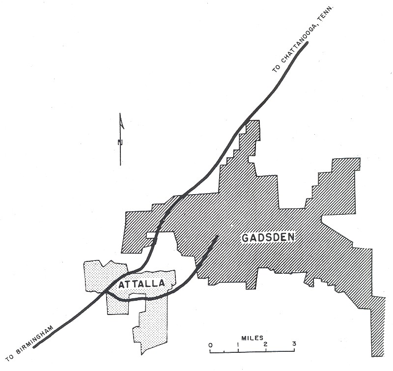
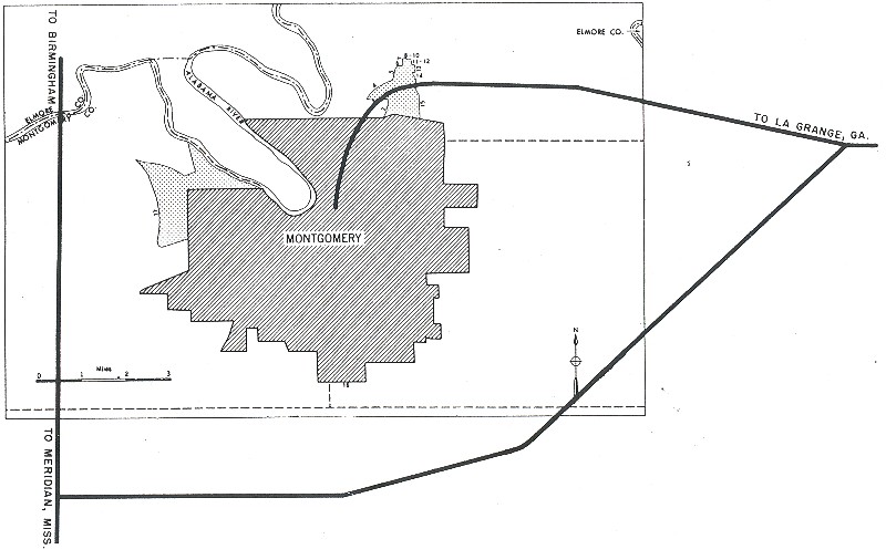
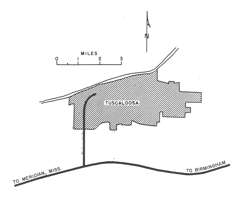
Alabama: Birmingham, Gadsden, Montgomery, Tuscaloosa
Arkansas: Fort Smith, Little Rock
California: Los Angeles, San Francisco
Colorado: Denver
Connecticut: Hartford
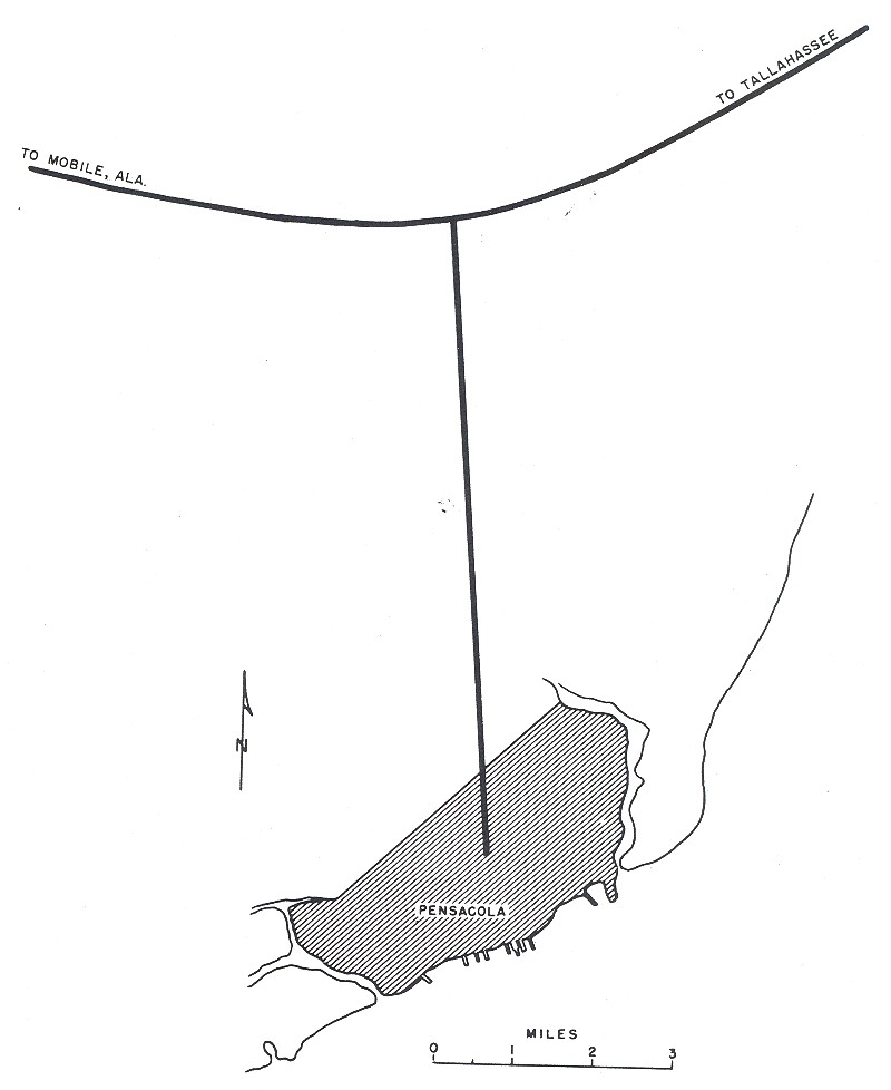
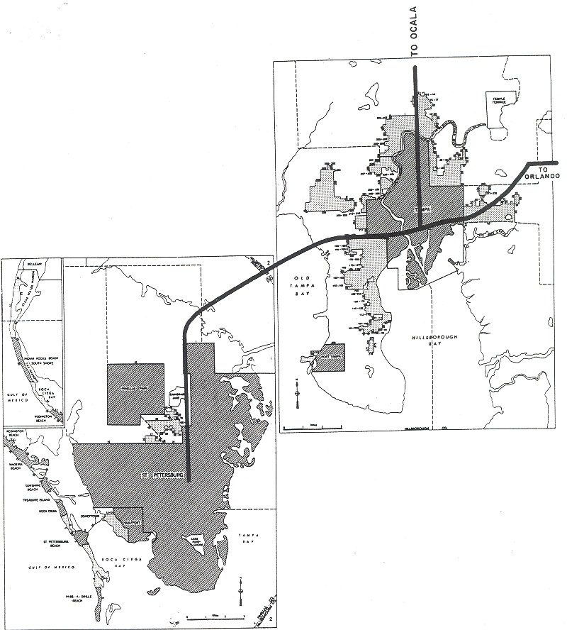
Florida: Miami, Pensacola, Tampa/St. Petersburg
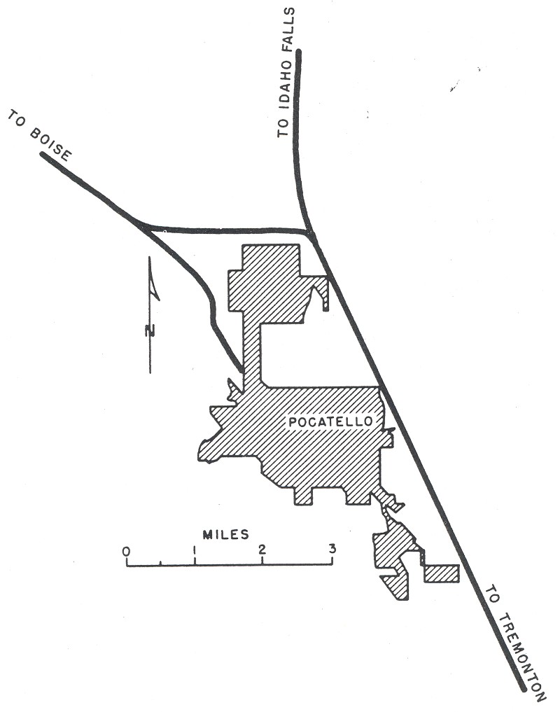
Idaho: Pocatello
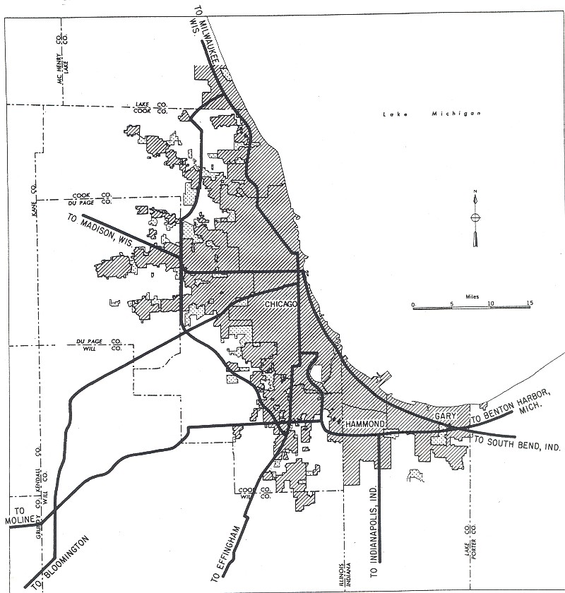
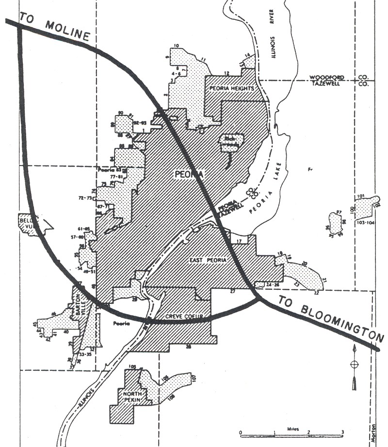
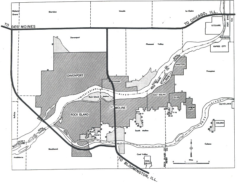
Illinois: Chicago, Peoria, Quad Cities
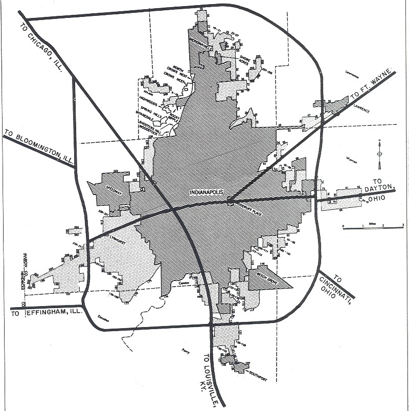
Indiana: Indianapolis
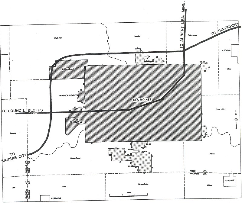
Iowa: Des Moines, Quad Cities
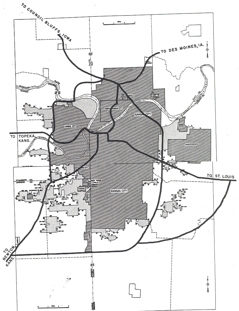
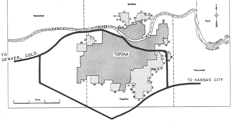
Kansas: Kansas City, Topeka, Wichita
Kentucky: Louisville
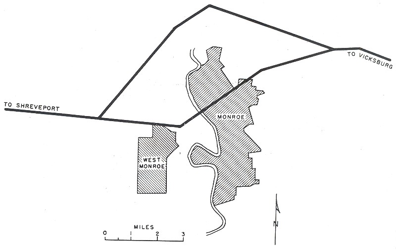
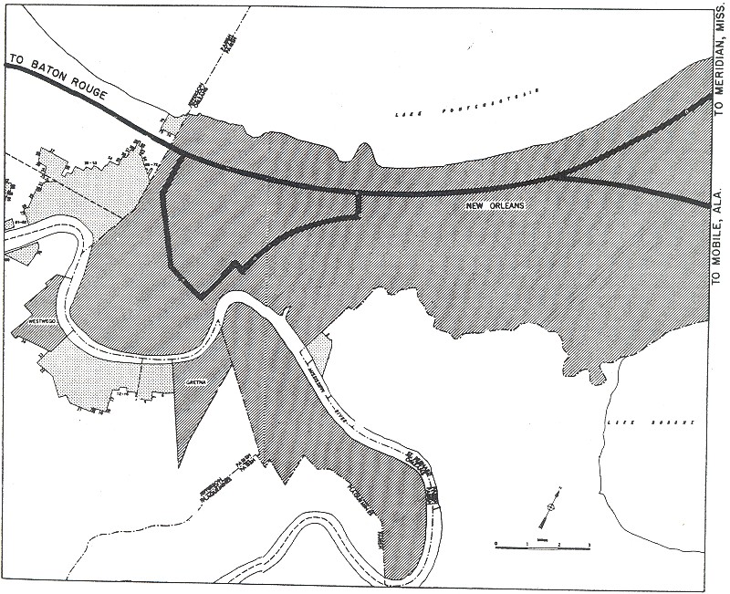
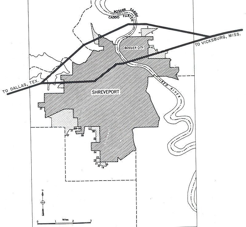
Louisiana: Baton Rouge, Lake Charles, Monroe, New Orleans, Shreveport
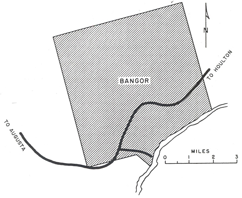
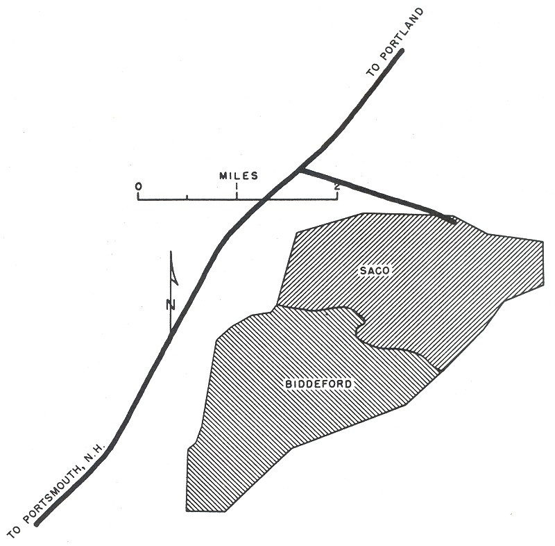
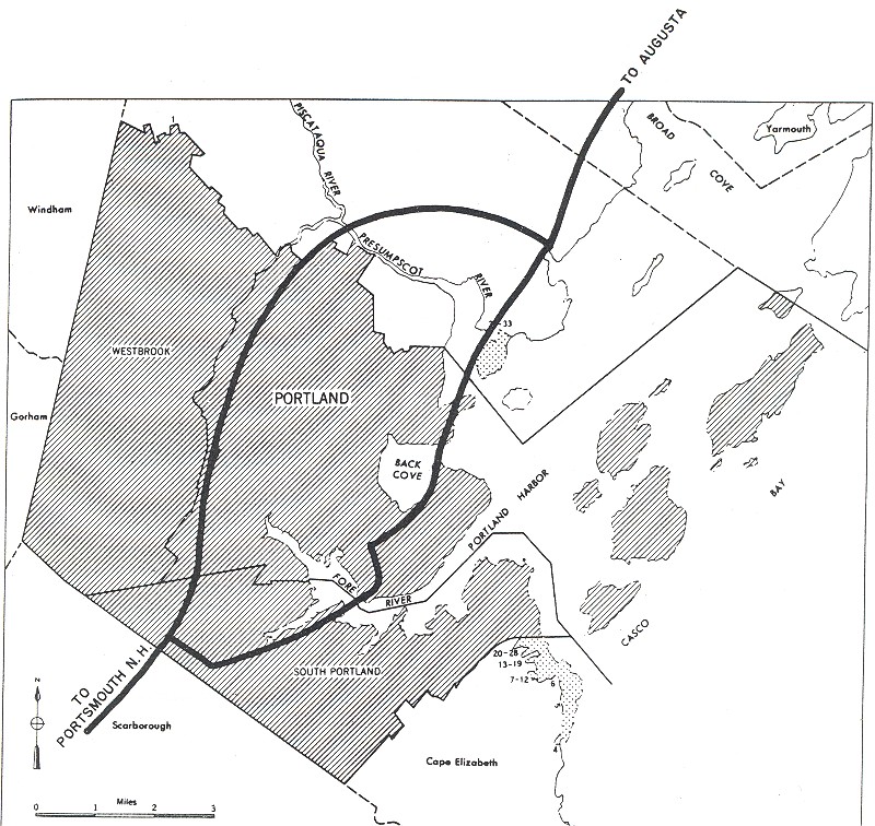
Maine: Bangor, Biddeford/Saco, Portland
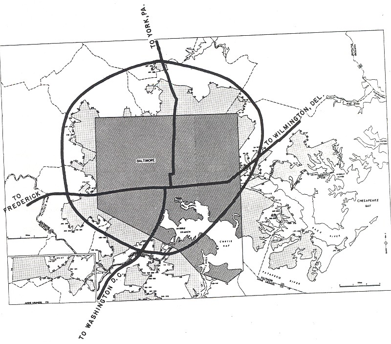
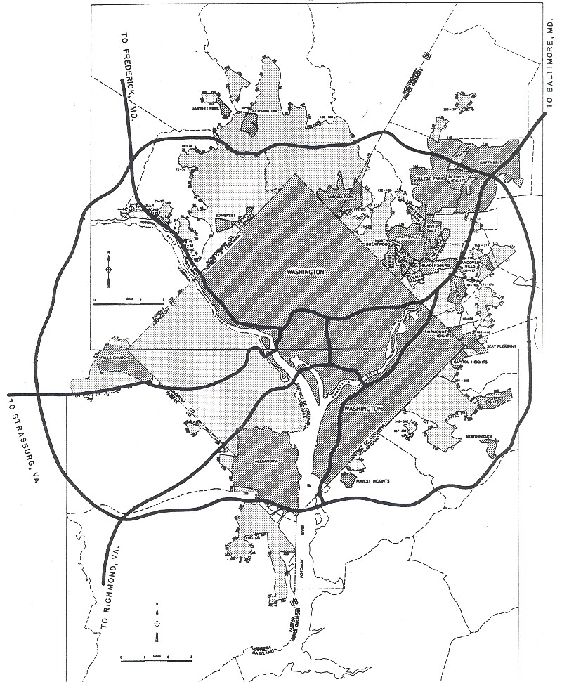
Maryland: Baltimore
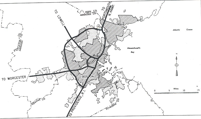
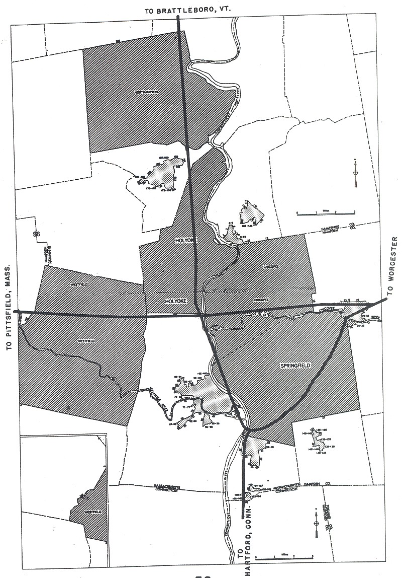
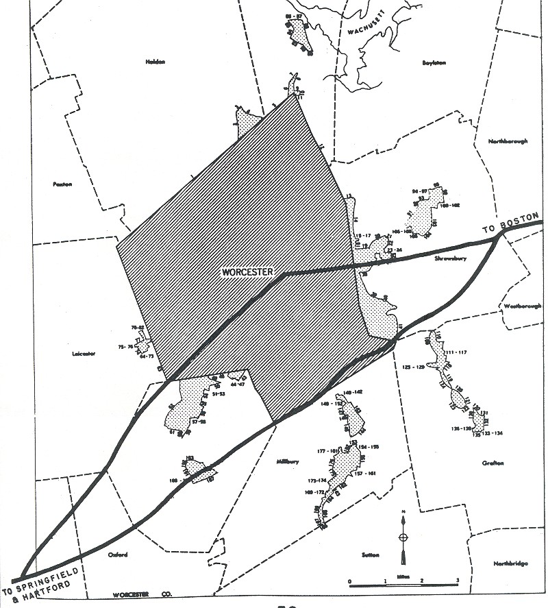
Massachusetts: Boston, Springfield, Worcester
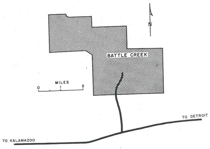
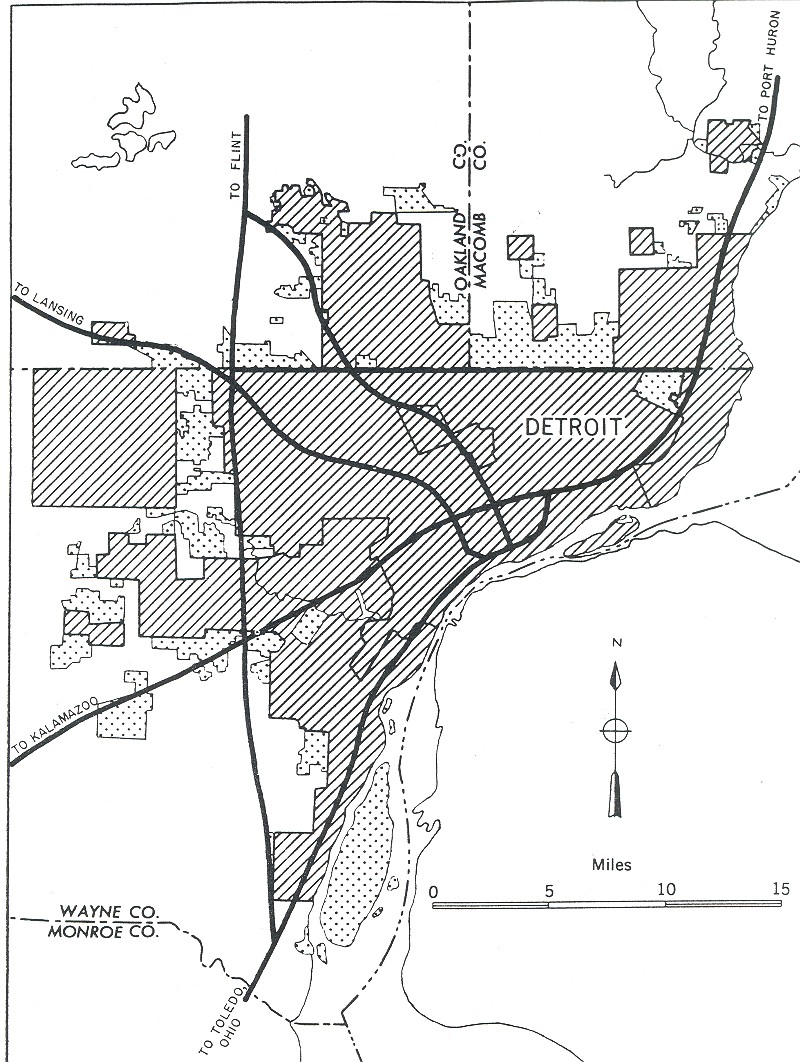
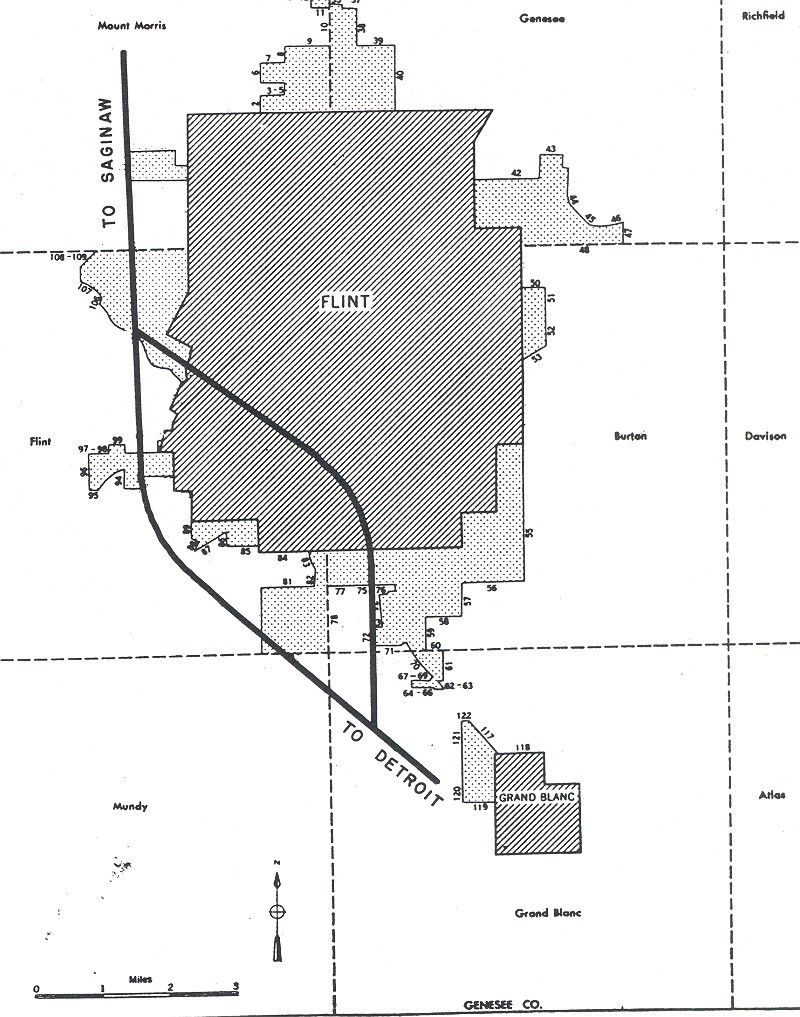
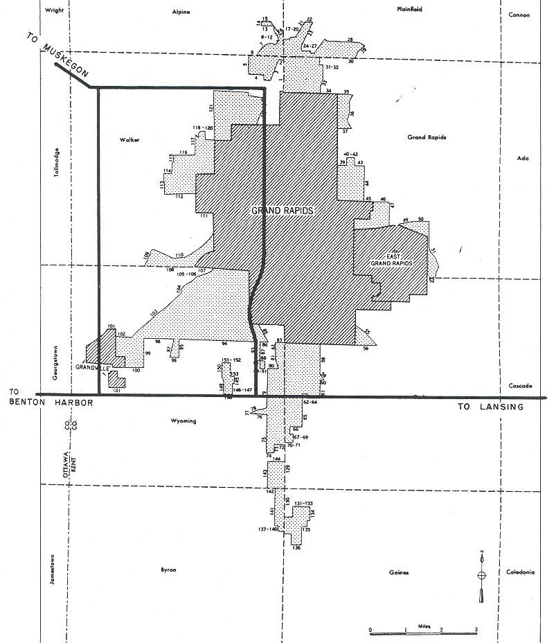
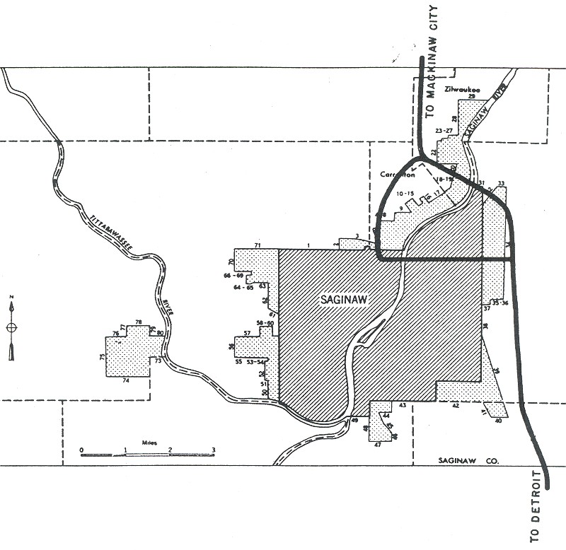
Michigan: Battle Creek, Detroit, Flint, Grand Rapids, Lansing, Saginaw
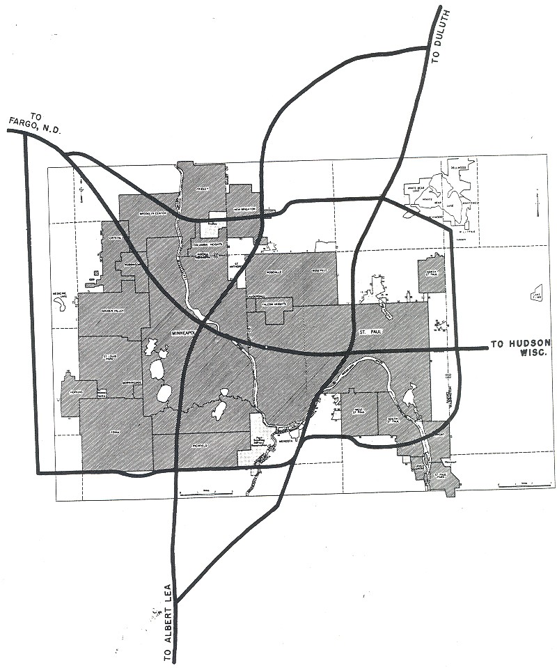
Minnesota: Minneapolis/St. Paul
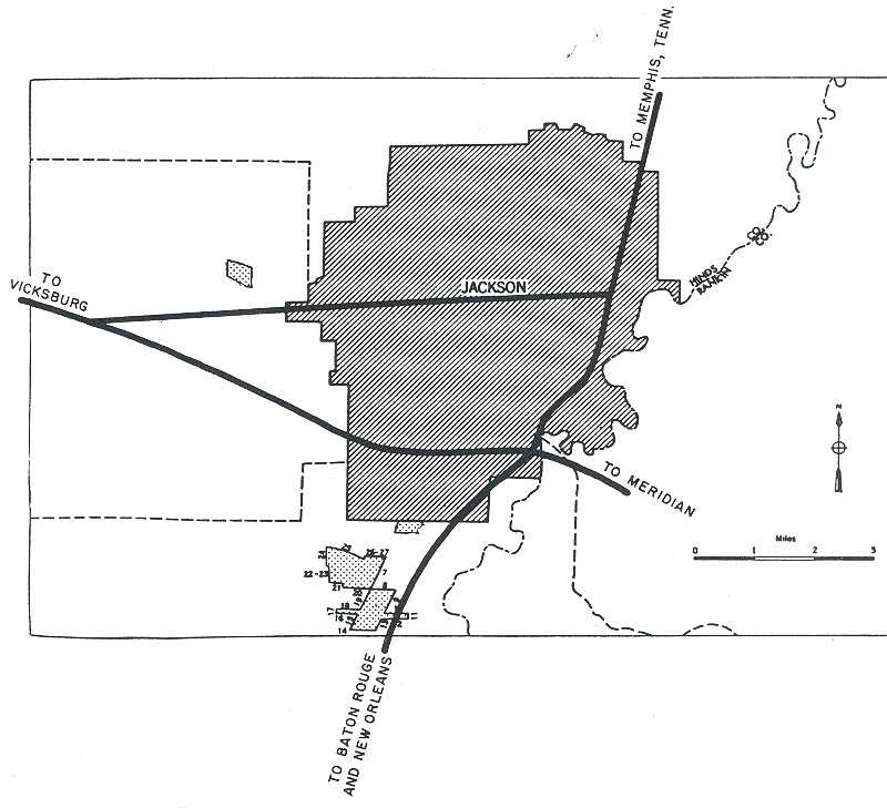
Mississippi: Jackson
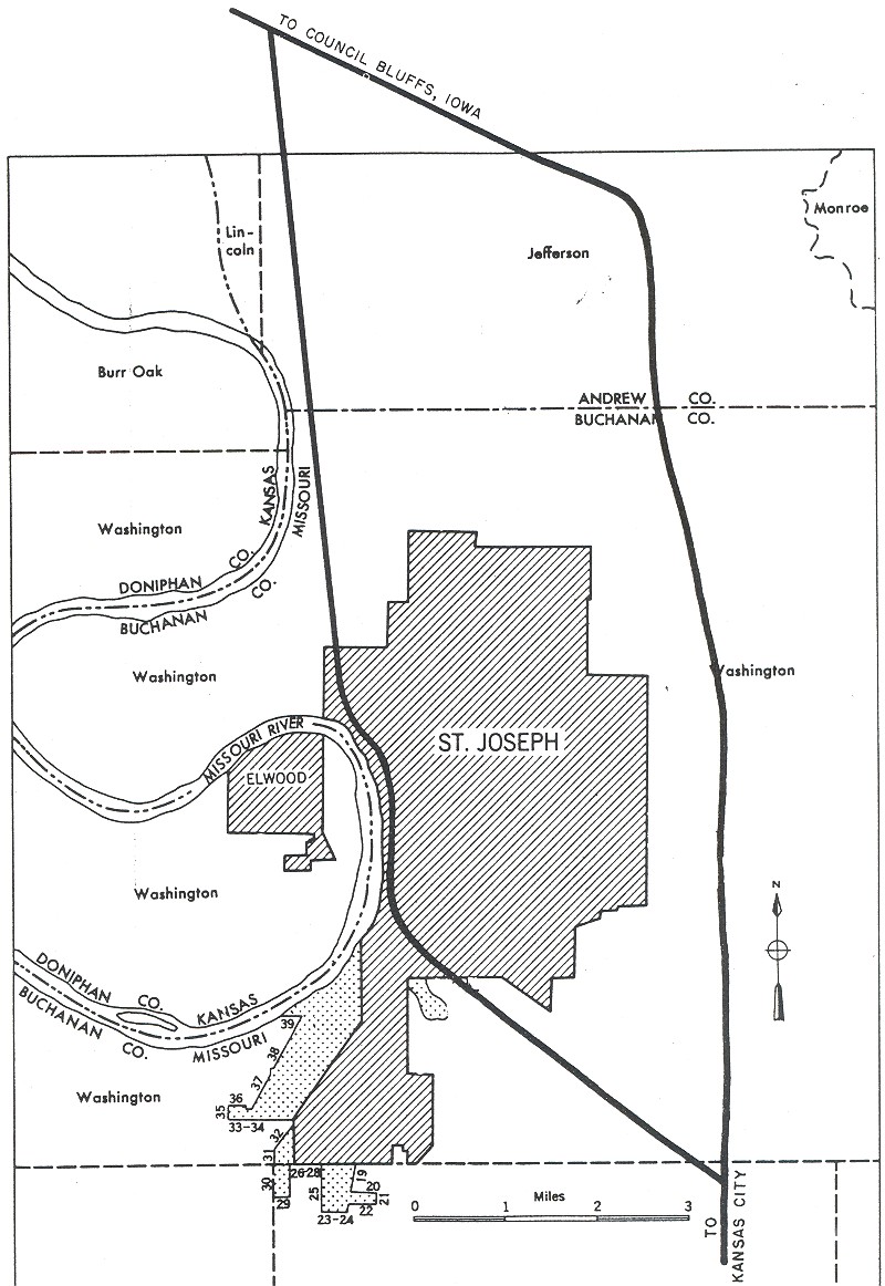
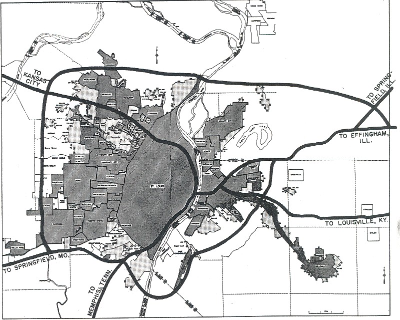
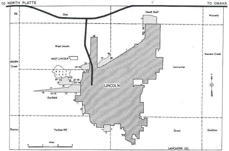
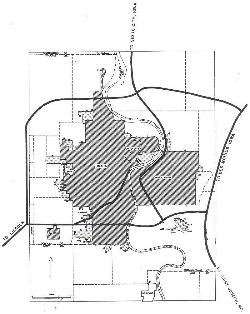
Missouri: Kansas City, St. Joseph, St. Louis
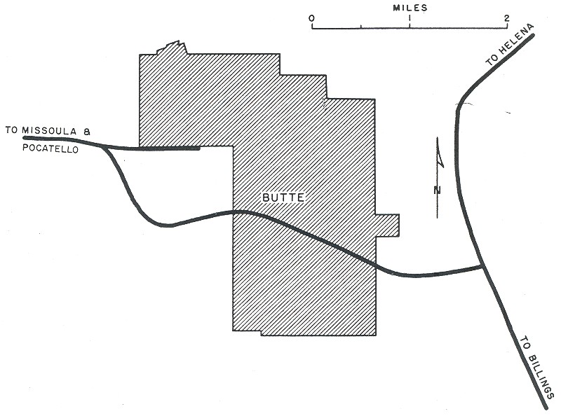
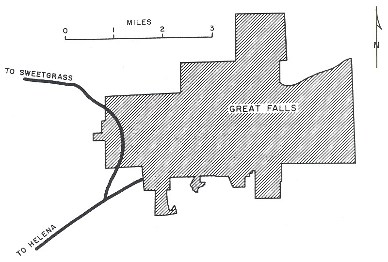
Montana: Butte, Great Falls
New Hampshire: Manchester
New Jersey: Camden, Newark/Jersey City
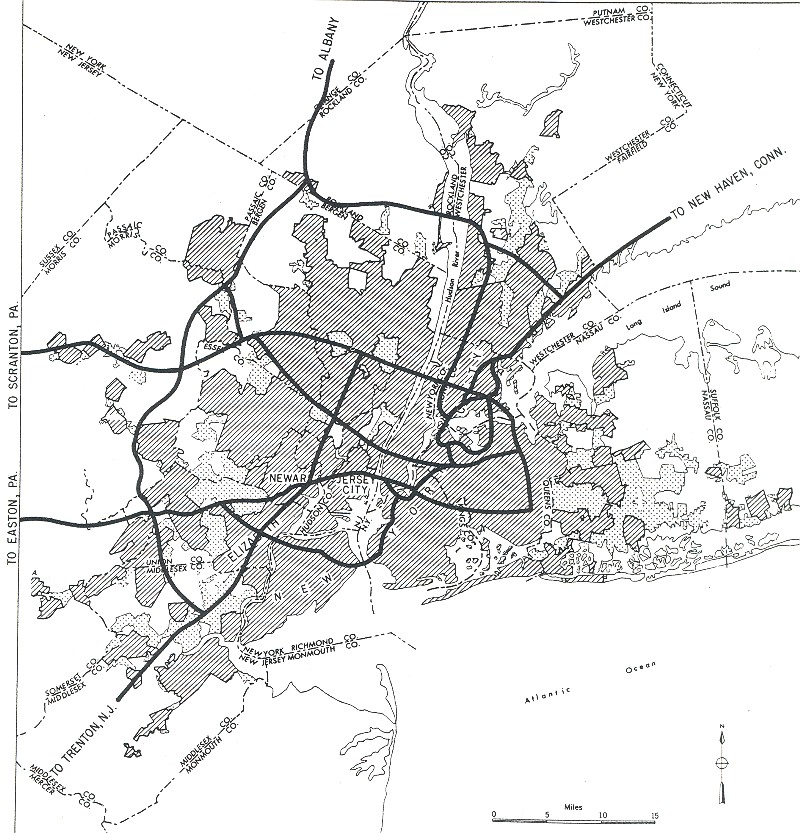
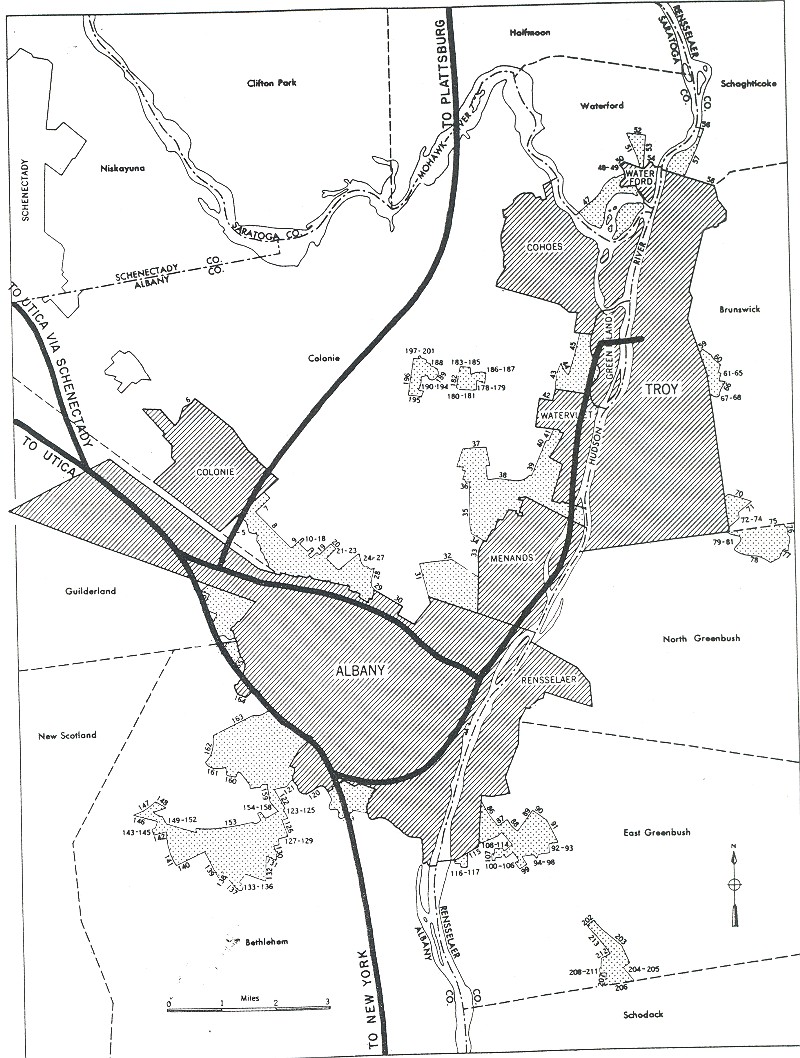
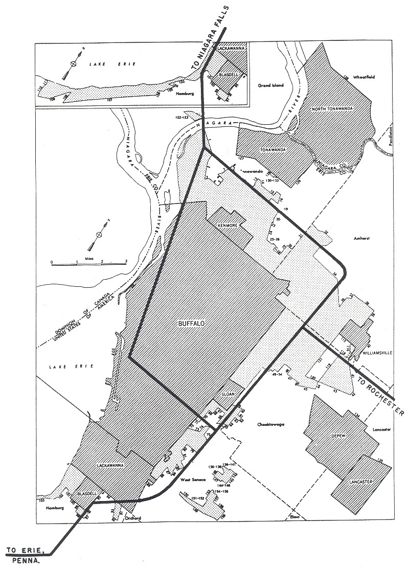
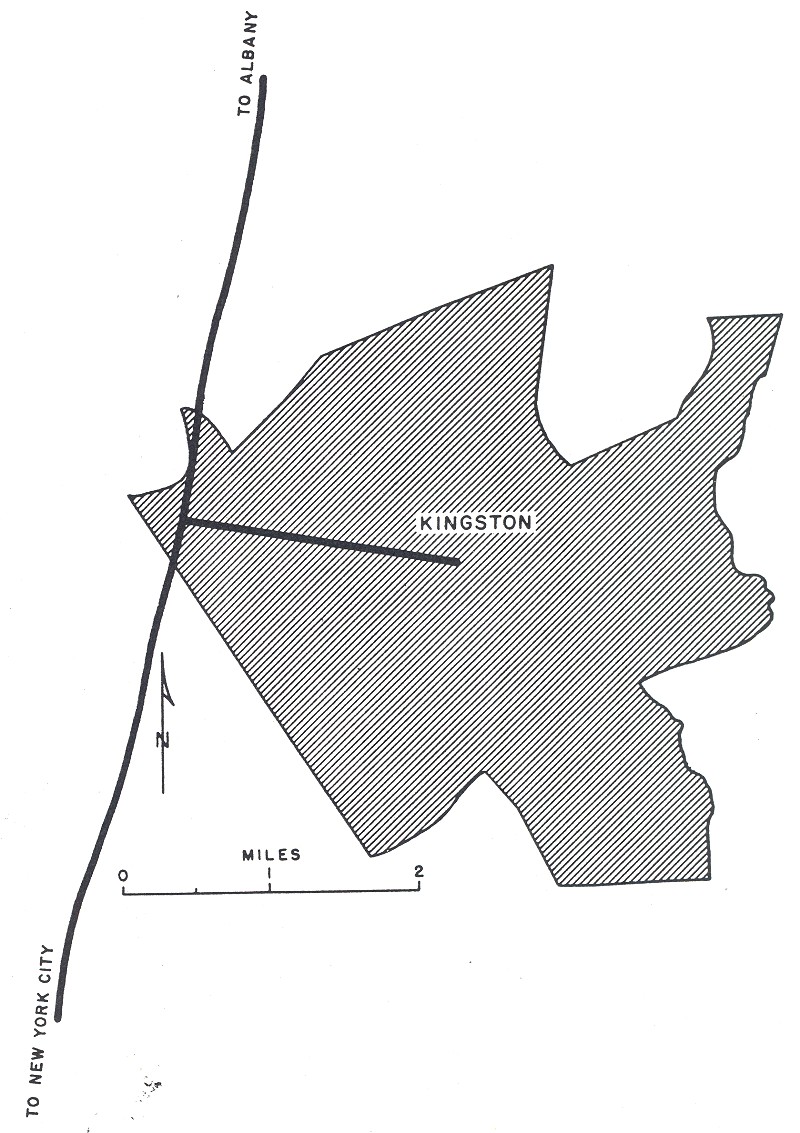
New York: Albany, Buffalo, Kingston, New York City, Rochester, Schenectady, Syracuse, Utica
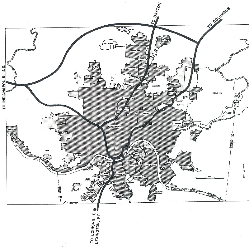
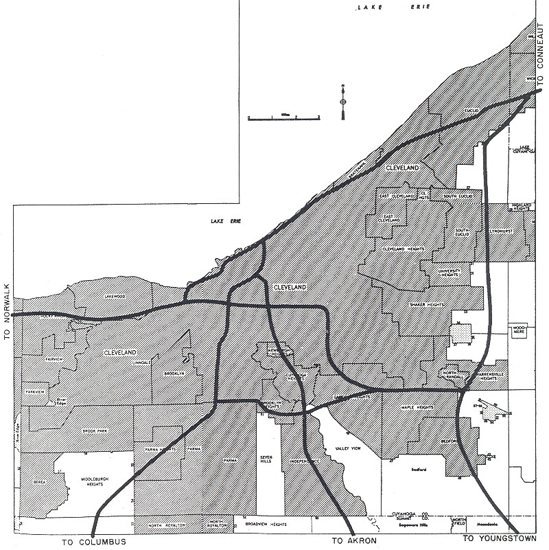
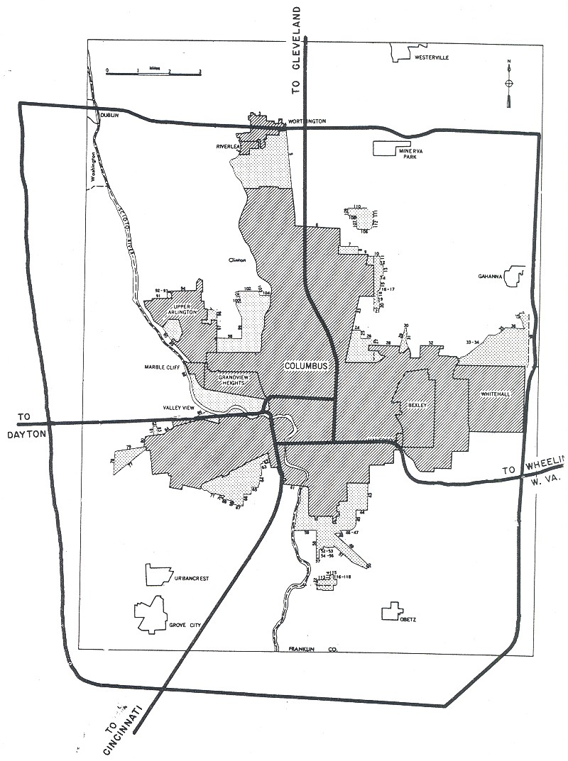
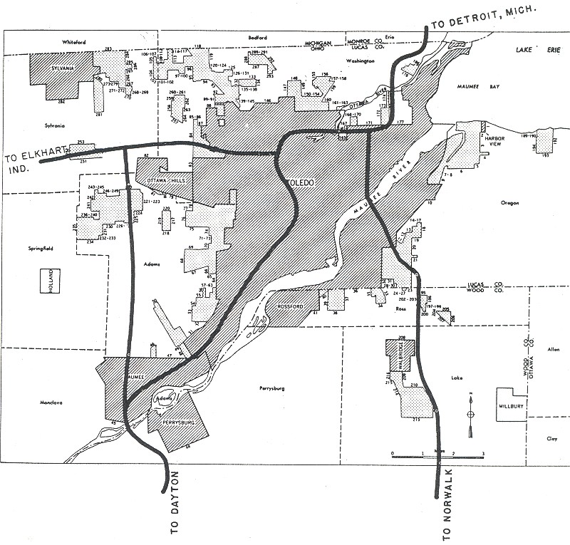
Ohio: Cincinnati, Cleveland, Columbus, Toledo
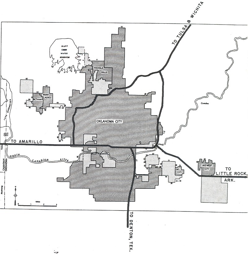
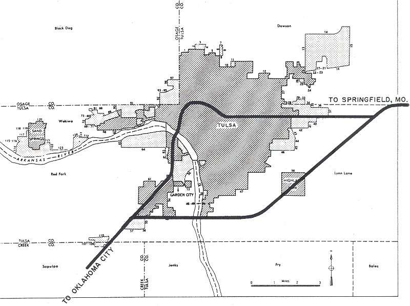
Oklahoma: Oklahoma City, Tulsa
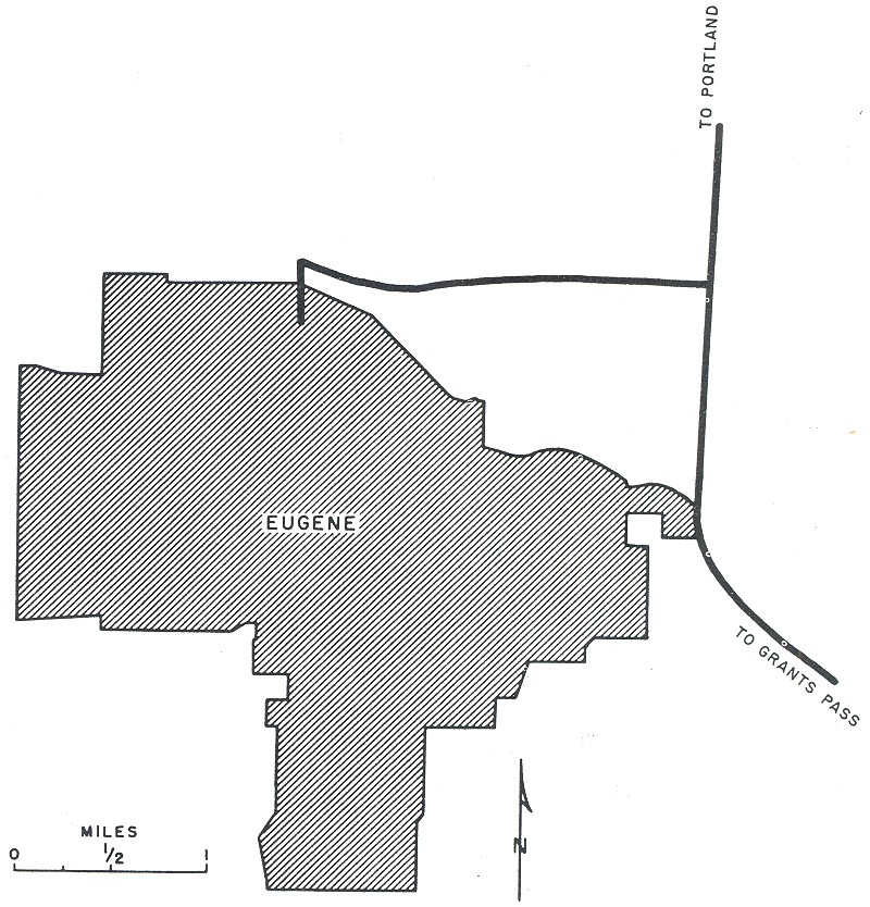
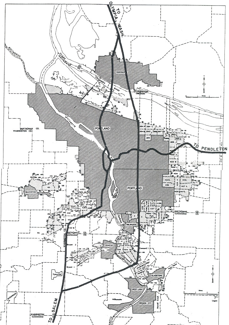
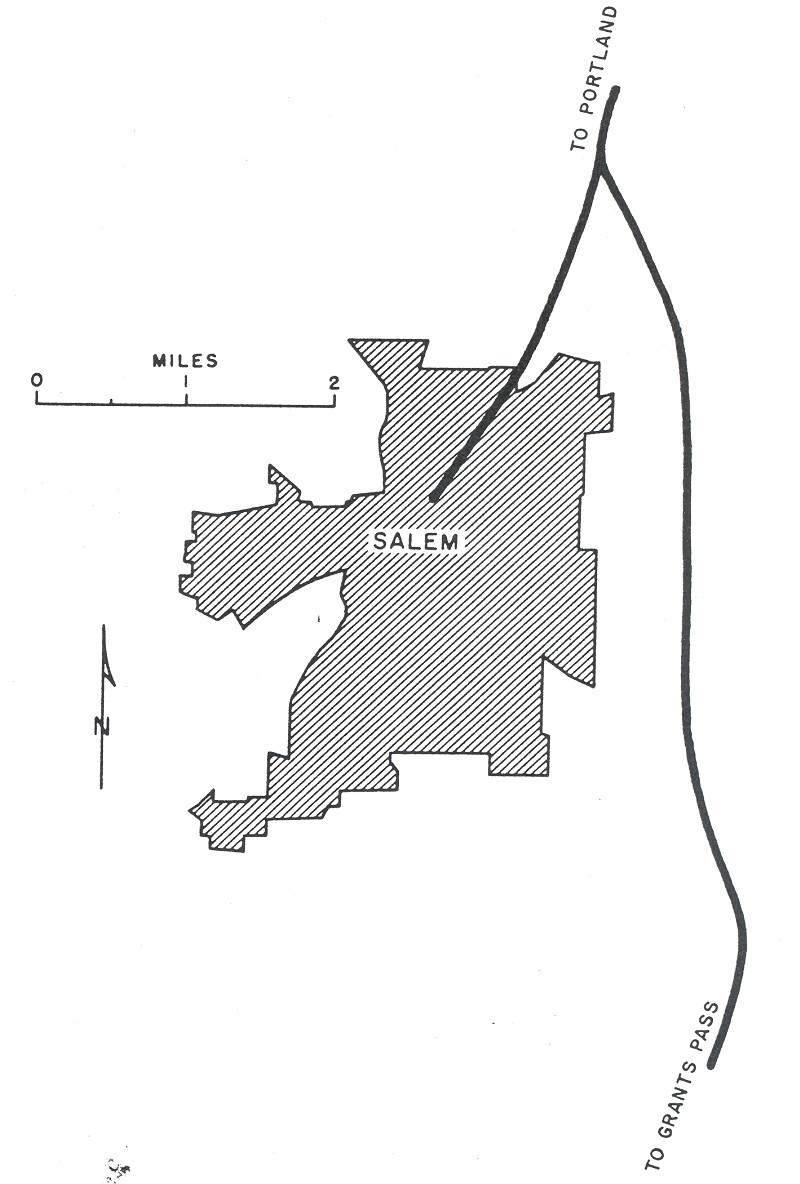
Oregon: Eugene, Portland, Salem
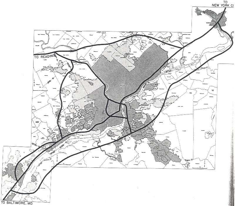
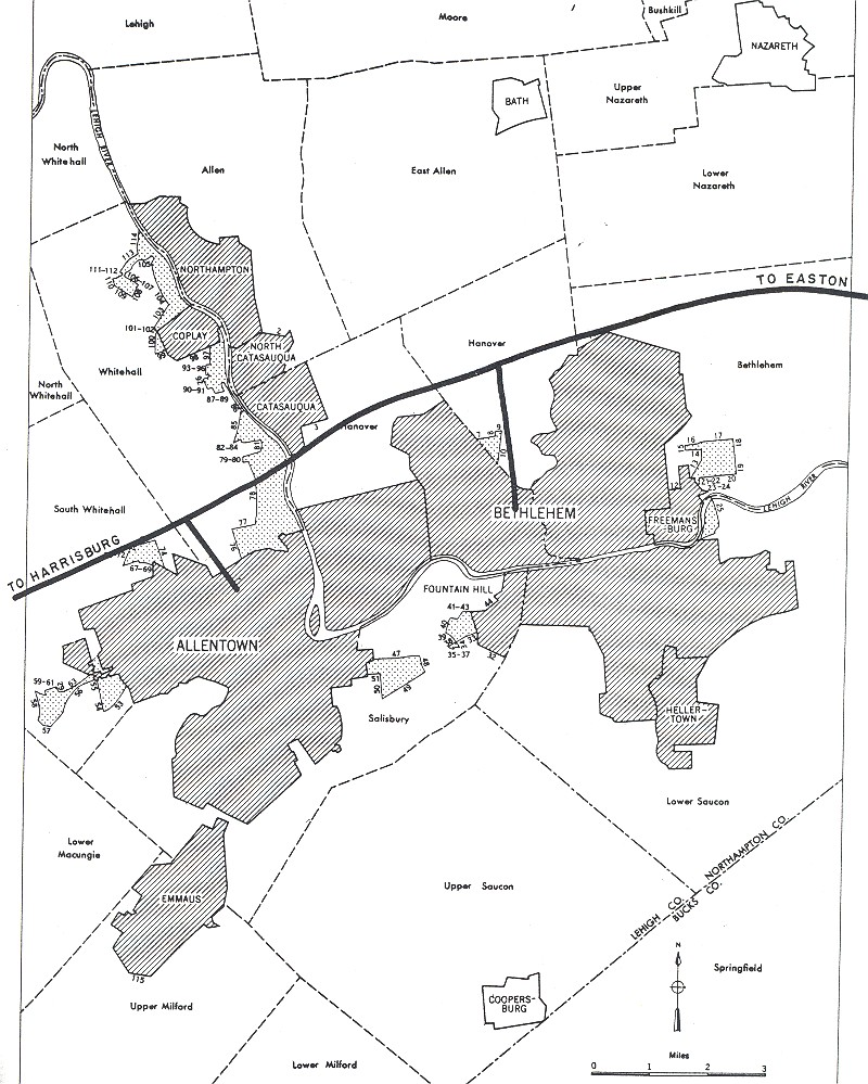
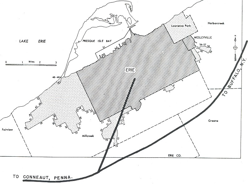
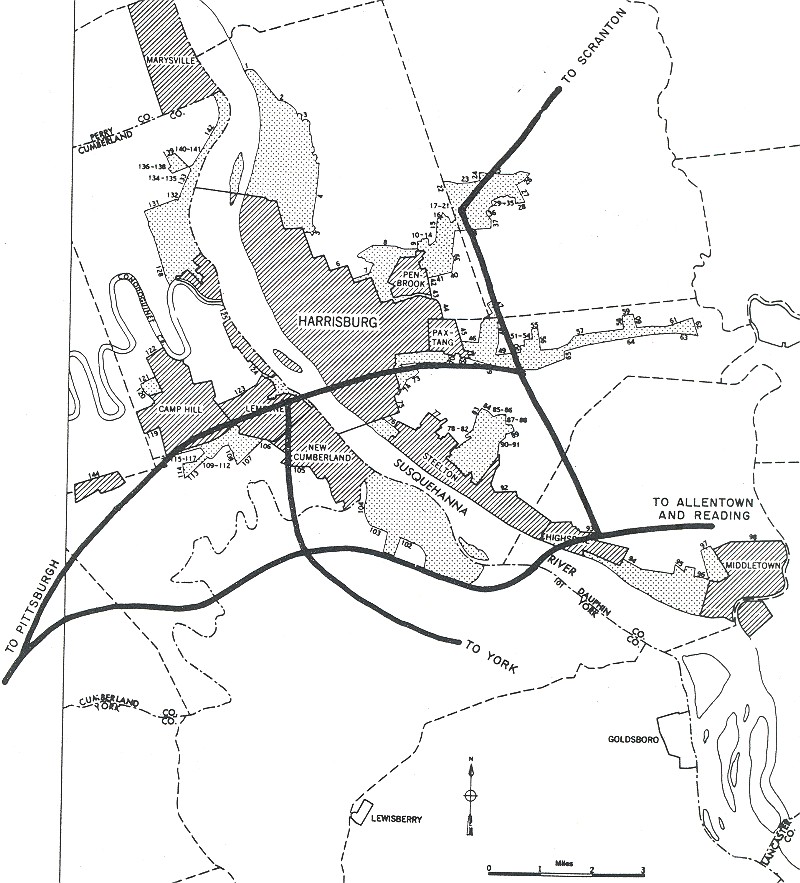
Pennsylvania: Allentown, Erie, Harrisburg, Philadelphia, Pittsburgh, Reading
Rhode Island: Providence
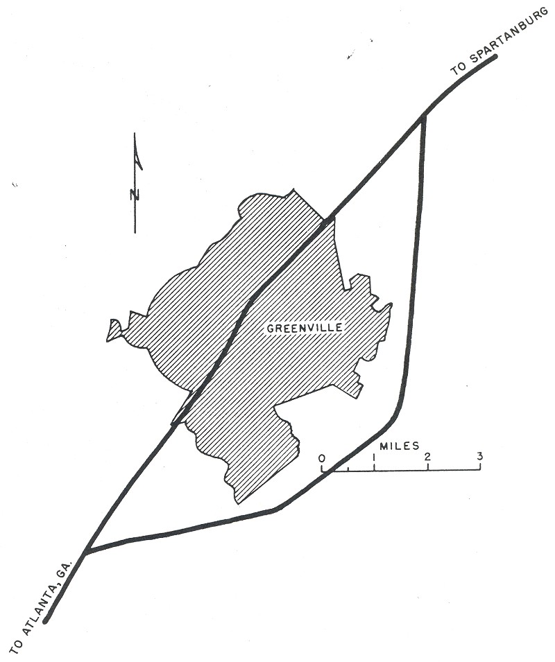
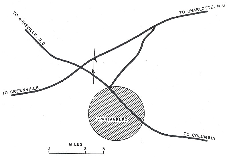
South Carolina: Columbia, Greenville, Spartanburg
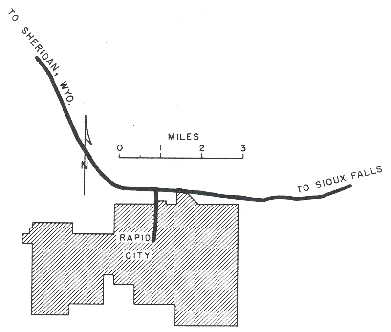
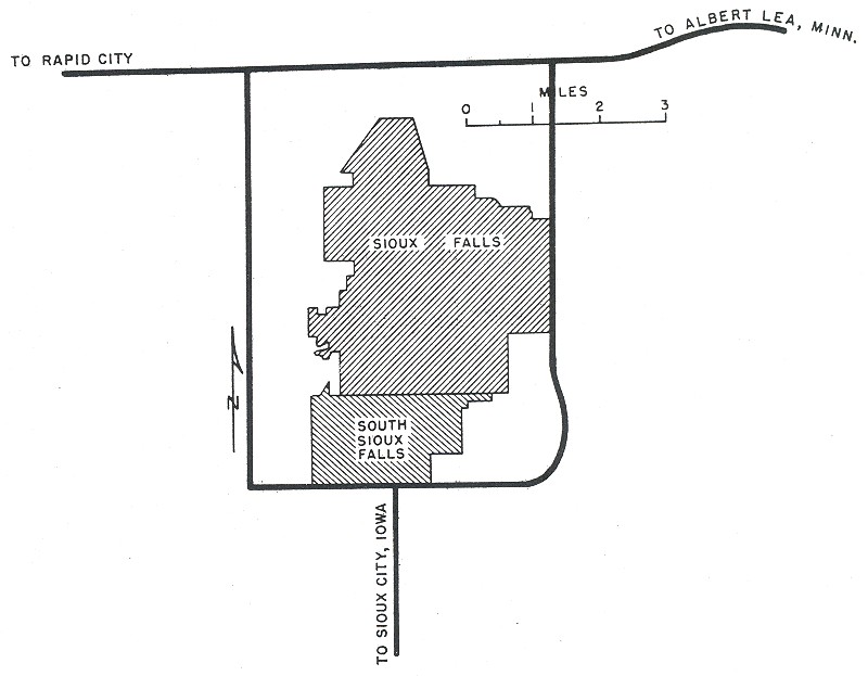
South Dakota: Rapid City, Sioux Falls
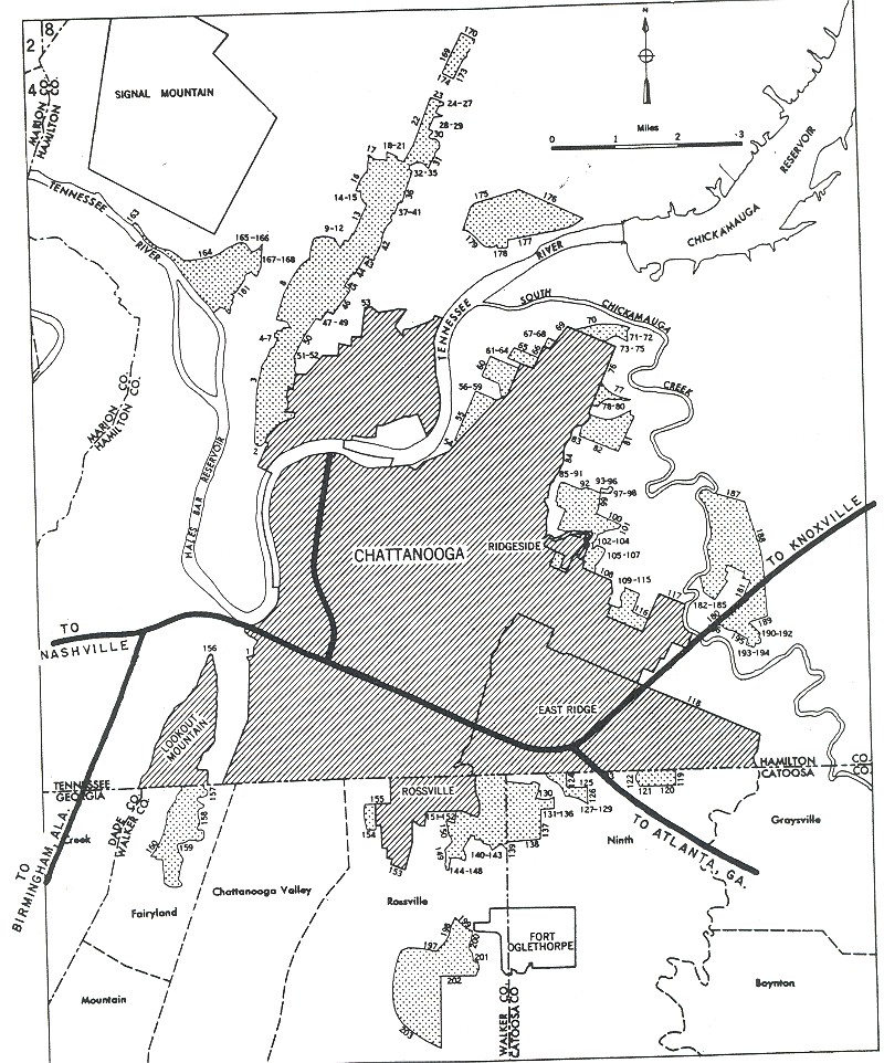
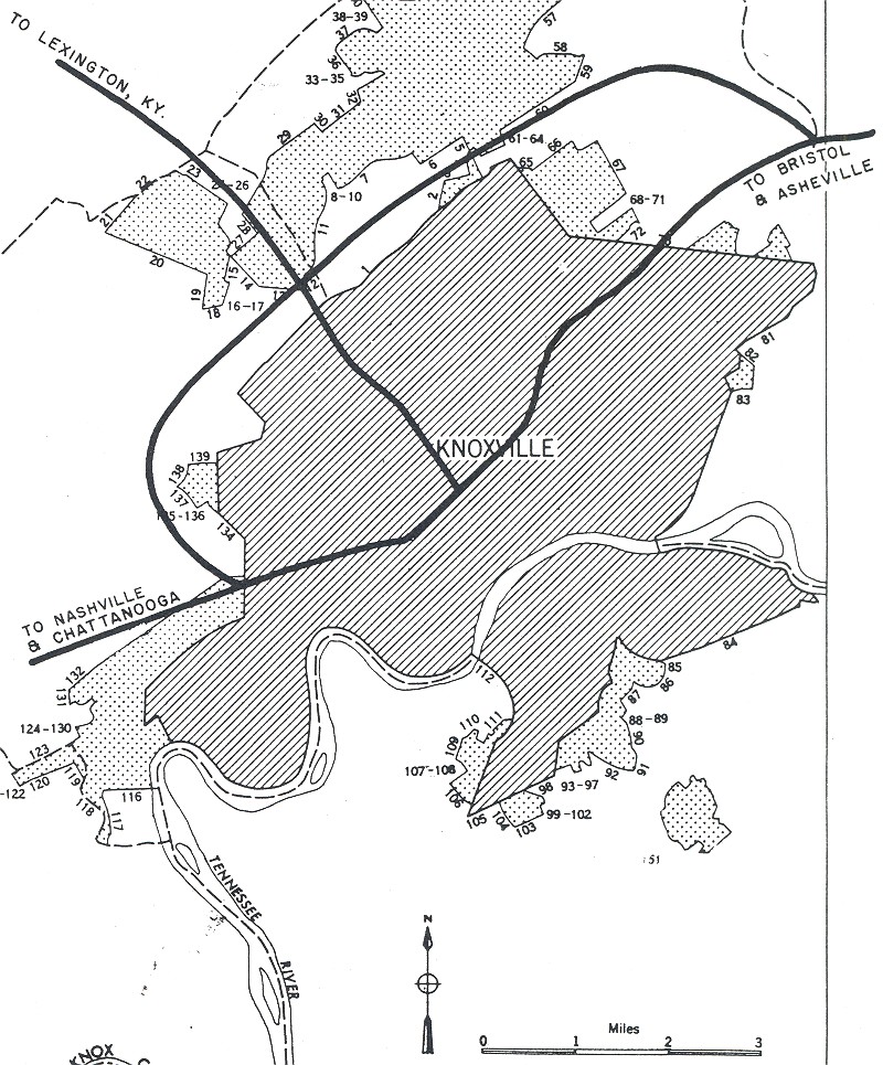
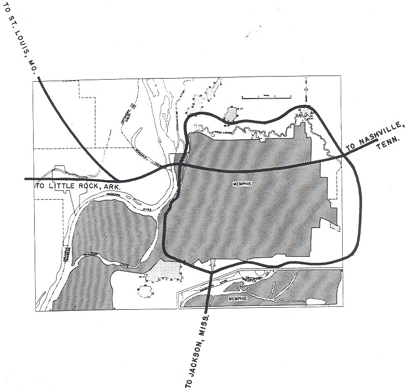
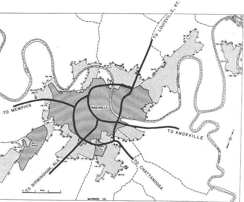
Tennessee: Chattanooga, Knoxville, Memphis, Nashville
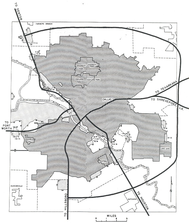
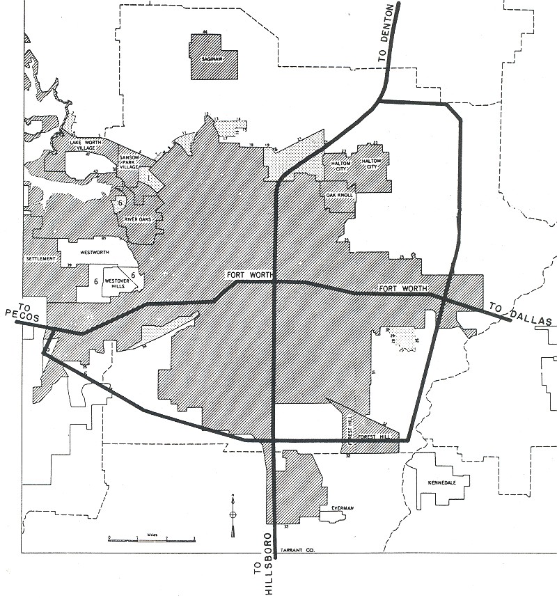
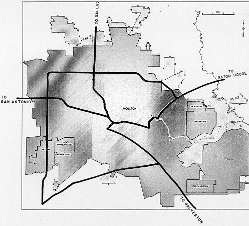
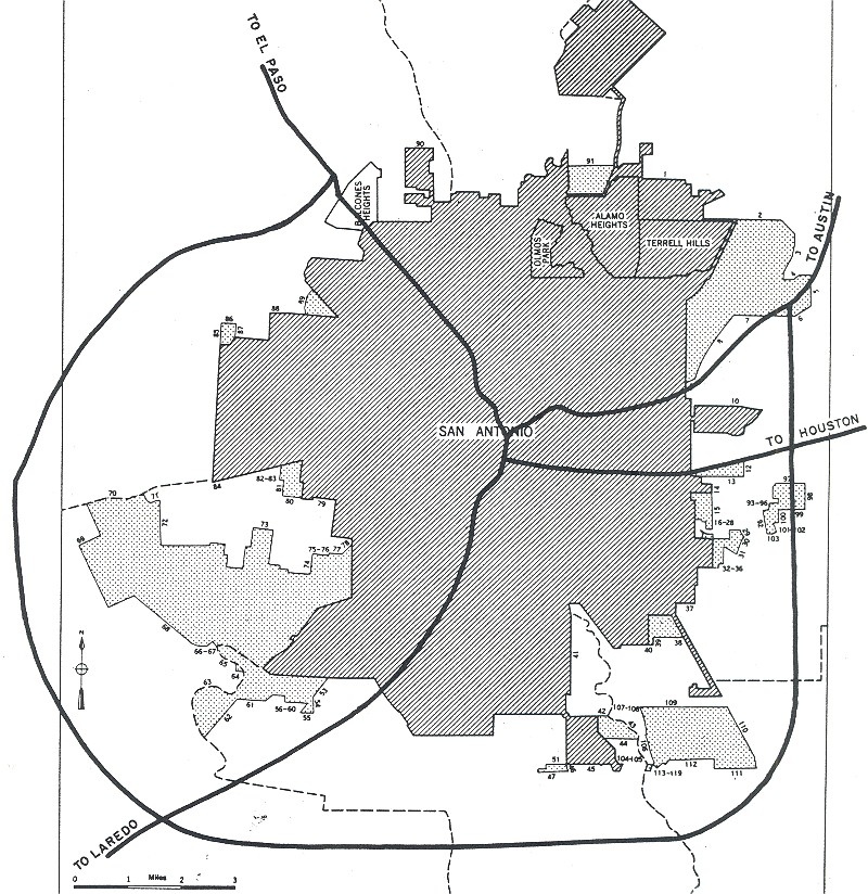
Texas: Dallas, Ft. Worth, Houston, San Antonio
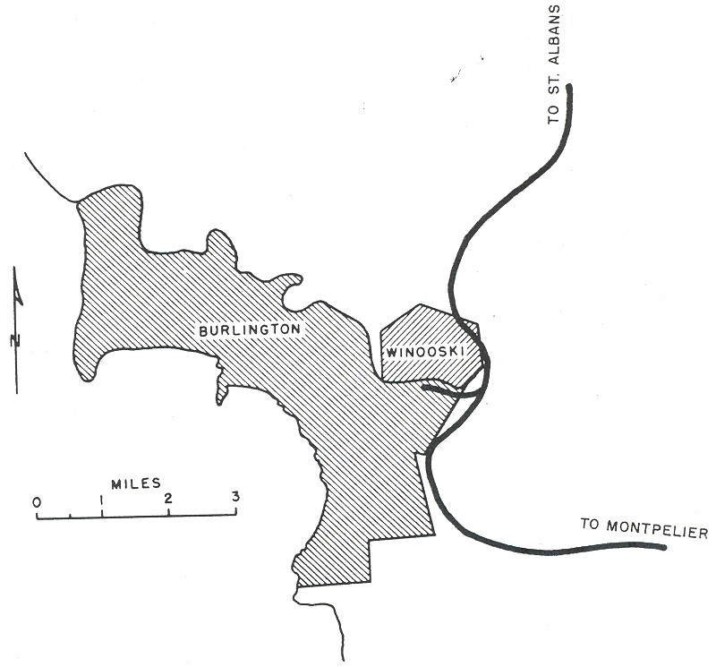
Vermont: Burlington
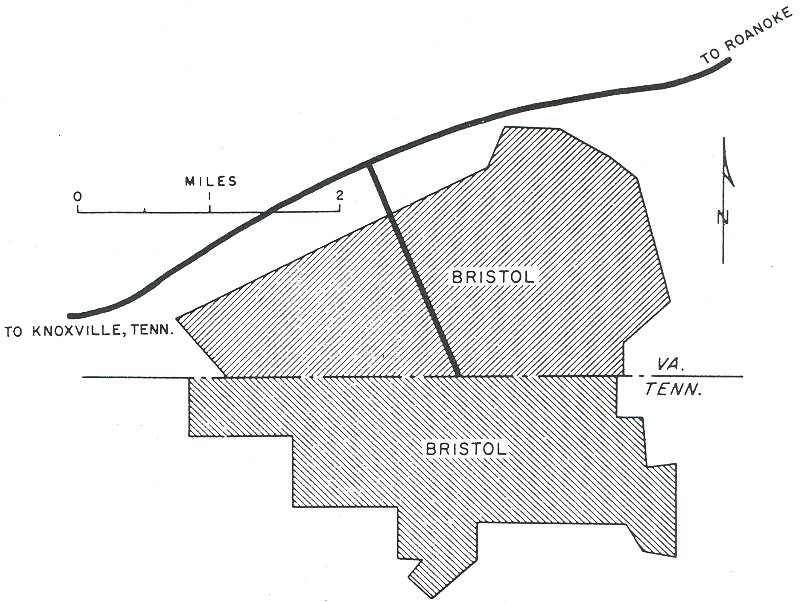
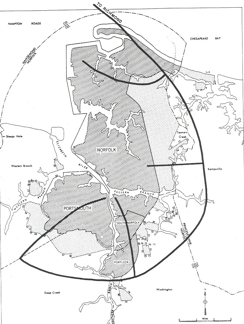
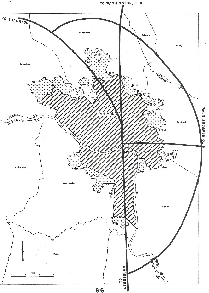
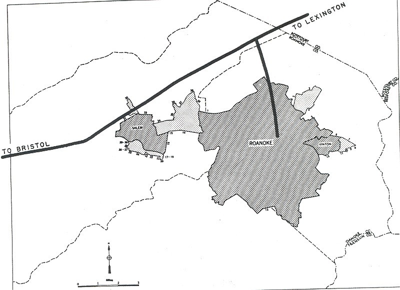
Virginia: Bristol, Norfolk, Richmond, Roanoke
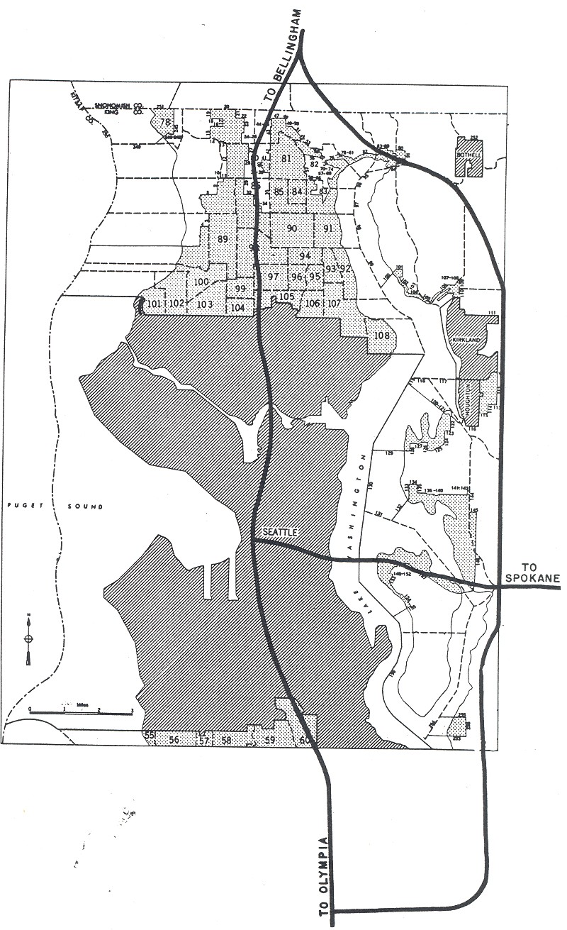
Washington: Seattle
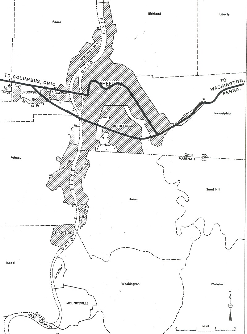
West Virginia: Wheeling
Wisconsin: Milwaukee
Related Links: