Interstate System Urban Freeway Plans
"Yellow Book"
FHWA Interstate Highway System History
President Franklin Roosevelt proposed the Inter-Regional Highway System in 1939. He commissioned Thomas MacDonald of the Bureau of Public Roads to study the concept. The Bureau of Public Roads worked with the 48 state highway departments in 1940 and 1941 to develop the conceptual system. The Bureau initially based its plan on the US War Departments Strategic Highway Network that was studied under General Pershing in 1921. This 78,000 mile network linked all the cities and ports that is now recognized today as the National Highway System
The Inter-Regional System study was submitted to Congress in 1941 under the title: Interregional highways. Message from the President of the United States, transmitting a report of the National interregional highway committee, outlining and recommending a national system of interregional highways by the National Interregional Highway Committee, US GPO 1944, Library of Congress call number, TE23 .A5 1944 (Ohio State Library).
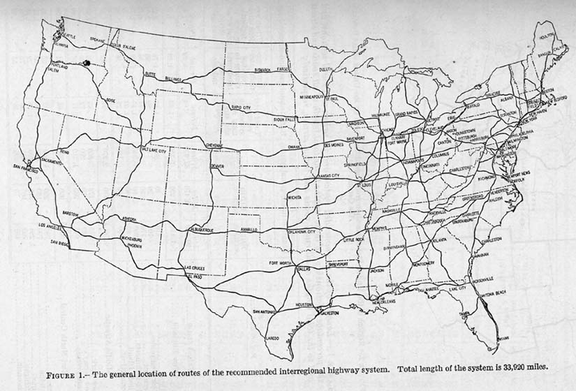
Map 1 -- The proposed recommended system
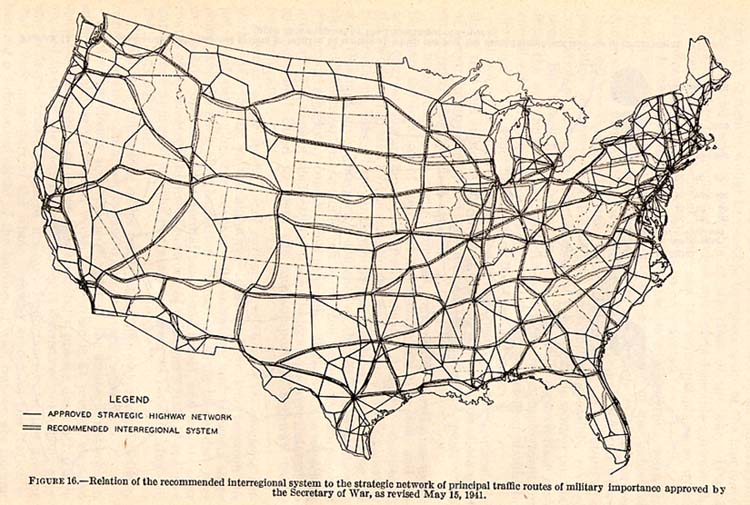
Map 2 -- Comparison of the Secretary of War's Strategic Highway Network from May of 1941 and the proposed interregionals
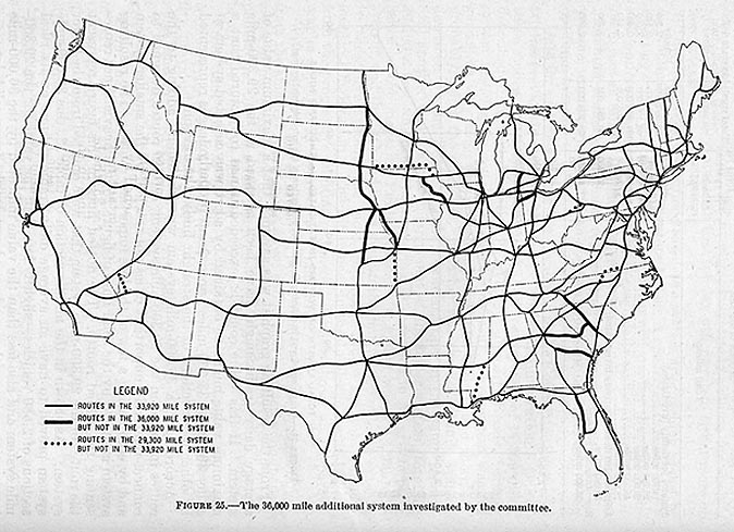
Map 3 -- This is a meshing of three proposals
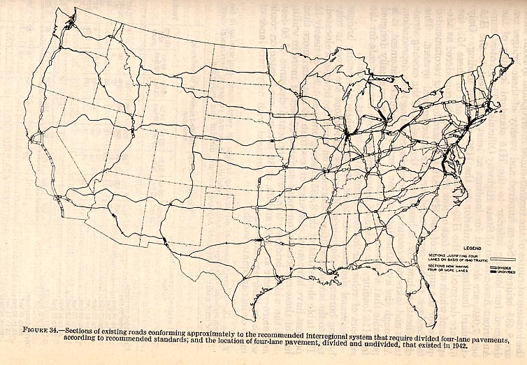
Map 4 -- Capacity concerns
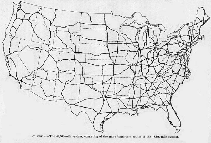
Map 5 -- Larger proposed system (selected routes from system in Map 6)
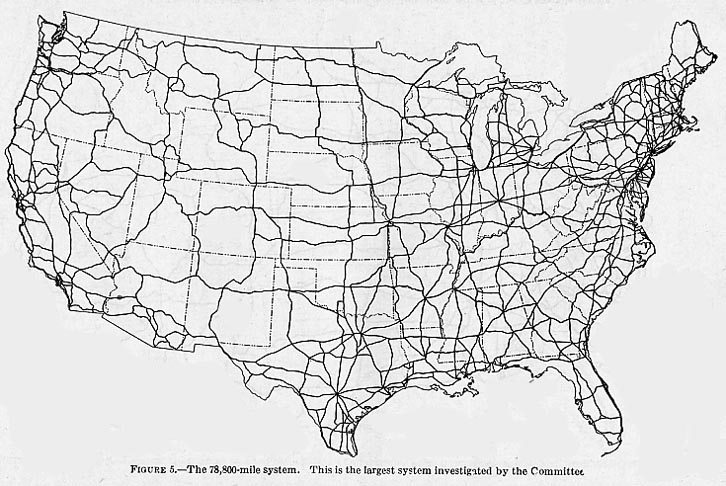
Map 6 -- Largest proposed system
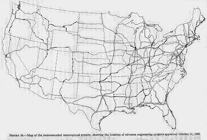
Map 7 -- Proposed recommended system (Map 1) with upgrade locations
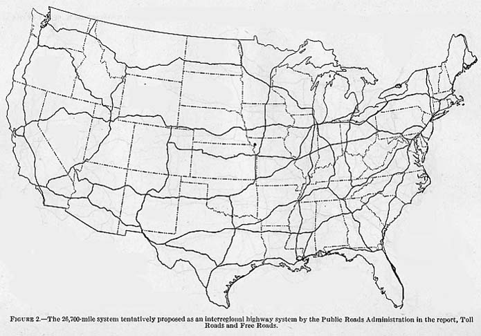
Toll Roads and Free Roads
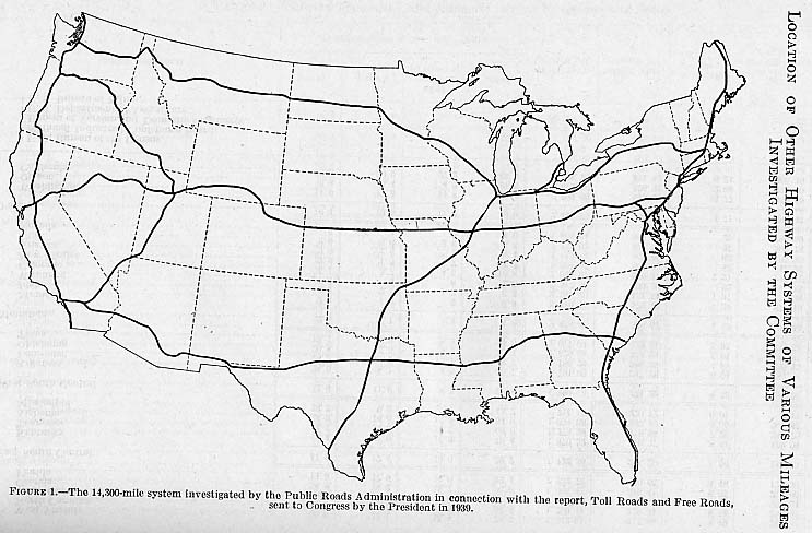
Interregional Highways study was related to an earlier publication, Toll Roads and Free Roads (1939), both influenced by Herbert S. Fairbank. Maps produced in Toll Roads and Free Roads was included in Interregional Highways Study:Map 1 -- Smaller proposed system
Map 2 -- Larger proposed system
The "Yellow Book", official title General Location of National System of Interstate Highways, including all additional routes at urban areas designated in September, 1955 ("Yellow Book", is the original plan for the Interstate system. Number designations were not yet assigned to the routes. Maps were published in the "Yellow Book" for many urban freeway plans. The national map with route numbers from 1957 and 1958: 1958 Number Designations; Proposals submitted in 1970 for 1500 miles of Interstate System additions. The US Department of Transportation Federal Highway Adminstration (FHWA) replaced the Department of Commerce Bureau of Public Roads under in the 1960's. The FHWA published the history of the "Eisenhower" Interstate System for its 50th anniversary in 2006.